Icknield Street
Icknield Street is in Roman Roads.
Icknield Street, aka Ryknild Street, is a Roman Road from Bourton-on-the-Water [Map] to Templeborough [Map]. Icknield Street is road RM18 in Ivan Margary's book 'Roman Roads in Britain'.
Between 43AD and 68AD an earth and wood Roman fort was first built at Templeborough [Map]. It was later rebuilt in stone. It is thought to have been occupied until the Roman withdrawal from Britain c. 410. Icknield Street crossed the River Don near the fort.
43AD. Metchley Roman Fort [Map] was a Roman Fort on Icknield Street constructed soon after the Roman invasion in 43AD. The fort was around 200 square metres in area and was defended by a turf and earth bank with a timber wall, towers and double ditches. In AD 70, the fort was abandoned, only to be reoccupied a few years later before being abandoned again in AD 120.
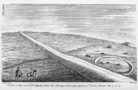
Stonehenge by William Stukeley. Table IV. A view a little beyond Woodyates where the Ikening Street crosses part of a Druid's barrow. Jun 9 1724.

Culture, England, Roman Roads, Icknield Street 18b Alcester to Wall ![]()
Icknield Street 18b Alcester to Wall. From Alauna [Map] aka Alcester Icknield Street travels through King's Coughton [Map], Studley [Map], Beoley [Map], Forhill Hilltop [Map], King's Norton [Map], Metchley Roman Fort [Map], Kingstanding [Map], Little Aston, Staffordshire [Map], Shenstone, Staffordshire [Map] before arriving at Ermine Street 2 just south of Letocetum, Staffordshire [Map] aka Wall.
Culture, England, Roman Roads, Icknield Street 18c Wall to Derby ![]()
Icknield Street 18c Wall to Derby. Leaving Letocetum, Staffordshire [Map] aka Wall the Icknield Way takes a new alignment through Lichfield [Map], Streethay [Map], past Alrewas, Staffordshire [Map], through Burton upon Trent, Staffordshire [Map], Toyota Island, Staffordshire [Map] crossing the River Derwent before reaching Derventio [Map] aka Derby.
Culture, England, Roman Roads, Icknield Street 18d Derby to Chesterfield ![]()
Icknield Street 18d Derby to Chesterfield. From Derventio [Map] aka Derby Icknield Street takes a new alignment past Morley [Map], Smithy Houses [Map], Street Lane [Map], Higham [Map], Oakerthorpe [Map], Clay Cross [Map] crossing the River Rother before arriving at Chesterfield [Map].
Culture, England, Roman Roads, Icknield Street 18e Chesterfield to Templeborough ![]()
Icknield Street 18e Chesterfield to Templeborough. The route of Icknield Street from Chesterfield [Map] to Templeborough [Map] is unknown. Speculatively it passed through Old Whittington [Map], Hundall [Map], Highlane, South Yorkshire [Map], Orgreave [Map].
Culture, England, Roman Roads, Icknield Street 18a Bourton to Alcester ![]()
Icknield Street 18a Bourton to Alcester. From Bourton-on-the-Water [Map] the Icknield Way travels to Slaughter Pike [Map] where it changes direction northwards to Lower Swell, Gloucestershire [Map], Condicote, Gloucestershire [Map], Hinchwich, Gloucestershire [Map], Springhill, Gloucestershire [Map], Weston-sub-Edge, Gloucestershire [Map], Ullington [Map] to Bidford-on-Avon [Map] where it crosses the Warwickshire River Avon before continuing through Wixford [Map] to Alauna [Map] aka Alcester.