The History of William Marshal was commissioned by his son shortly after William’s death in 1219 to celebrate the Marshal’s remarkable life; it is an authentic, contemporary voice. The manuscript was discovered in 1861 by French historian Paul Meyer. Meyer published the manuscript in its original Anglo-French in 1891 in two books. This book is a line by line translation of the first of Meyer’s books; lines 1-10152. Book 1 of the History begins in 1139 and ends in 1194. It describes the events of the Anarchy, the role of William’s father John, John’s marriages, William’s childhood, his role as a hostage at the siege of Newbury, his injury and imprisonment in Poitou where he met Eleanor of Aquitaine and his life as a knight errant. It continues with the accusation against him of an improper relationship with Margaret, wife of Henry the Young King, his exile, and return, the death of Henry the Young King, the rebellion of Richard, the future King Richard I, war with France, the death of King Henry II, and the capture of King Richard, and the rebellion of John, the future King John. It ends with the release of King Richard and the death of John Marshal.
Available at Amazon in eBook and Paperback format.
Selkley Hundred, Wiltshire is in Wiltshire.
Around 1700BC. Aldbourne Barrow 1013022 [Map]. Historic England: The monument includes two bowl barrows, aligned east-west, and set above the floor of a dry valley immediately south of Sugar Hill. The eastern barrow mound is 36m in diameter and stands to a maximum height of 1.5m. A ditch, originally dug to provide material for the barrow mound, is no longer visible at ground level but survives as a buried feature c.5m wide surrounding the mound. The western barrow is not visible as an earthwork but survives as a buried feature. The eastern barrow mound was partially excavated by Canon Greenwell, a prolific excavator of barrows, in the late 19th century. Finds included a cremation burial set on a wooden plank within a cairn, a bronze dagger, awls, faience and amber beads and a cup, later to become known as the "Aldbourne Cup".
The Giant's Grave Barrow [Map]. Historic England: The bell barrow, the most easterly in the group and known as the Giant's Grave, has a mound 19.5m in diameter and 2m in height. The base of the mound is surrounded by a berm up to 4.6m in width, with an external ditch 3.7m in width and 0.3m in depth. A depression in the mound 4m in diameter and 0.3m in depth is probably the site of a late 19th century excavation by Canon Greenwell, who recorded an adult cremation, two bone pins and a fragment of a barbed and tanged arrowhead.
The Ridgeway Path is an ancient footpath that extends from Knap Hill [Map], on the south of the Avebury Plateau, or The Sanctuary [Map], to Ivinghoe Beacon, Buckinghamshire [Map] - a distance of more than eighty miles following the scarp slopes. From Knap Hill [Map] the Ridgeway Path passes The Sanctuary [Map], Avebury Ridgeway Path [Map] where a path leads to the Avebury Henge East Entrance [Map], Barbury Castle [Map], Liddington Castle [Map], Wayland's Smithy Long Barrow [Map], Uffington Castle and White Horse [Map], Segsbury Camp [Map], Scutchamer Knob, Oxfordshire [Map], Goring, Oxfordshire [Map], Swyncome, Oxfordshire [Map], Chinnor, Oxfordshire [Map], Princes Risborough, Buckinghamshire [Map], Boddington Hill Fort, Buckinghamshire [Map], Tring, Hertfordshire [Map], Ivinghoe Beacon, Buckinghamshire [Map].
In 556 Cynric King Wessex and Ceawlin King Wessex defeated the Britons at Barbury Castle [Map] during the Battle of Beran Burg. Barbury Castle [Map] possibly of strategic importance since it is located on the Ridgeway with extensive views over the Thames valley.
The Wiltshire Wansdye remains highly visible in the landscape especially when it is crossing chalk downland that has little vegetation to hide it. Its date is somewhat uncertain; most sources consider it to have been constructed around 600AD give or take a hundred years either was. It was definitely constructed before the 9th century when begins to occur in charters.
It appears to start west of Savernake Forest [Map], after which it travels broadly west through Shaw Medieval Village [Map], Furze Hill [Map], Tan Hill, Wiltshire [Map], Shepherd's Shore, Wiltshire [Map], Furze Knoll [Map] after which it disappears, possibly being absorbed into the Roman Road
Fyfield Down is a 325 hectare biological and geological Site of Special Scientific Interest, notified in 1951. The down has the best assemblage of sarsen stones in England, known as the Grey Wethers.
Diary of Richard Symonds. Tuesday [12th November 1644], though a miserable wett windy day, the army moved over the playnes to Marlingsborough, where the King lay at the Lord Seymour's howse; the troopes to Fyfield, two myles distant, a place so full of a grey pibble stone of great bignes as is not usually scene; they breake them and build their howses of them and walls, laying mosse betweene, the inhabaitants calling them Saracens' stones, and in this parish, a myle and halfe in length, they lye so thick as you may goe upon them all the way. They call that place the Grey-weathers, because a far off they looke like a flock of sheepe.
Wiltshire Archaeological Magazine 1913 V38 Pages 379-414. Preshute. 1.1 [Preshute aka Rockley Long Barrow [Map]] On Manton Down, S.W. of Rockley, and N.W. of Manton House. Length 57ft.; S.E. and N.W. Chambered. The chamber seems to have been uncovered, and probably rifled at some unknown period. Hoare speaks of the barrow as "a small long barrow, covered with heath and furze, having a fallen kistvaen at the east end. The mound appears to have been set round with stones." The Rev. A. C. Smith also describes it as being so covered with heath and furze as "to be not easily discovered." This growth has now disappeared, the mound is grass-grown, and the partially-ruined chamber, or "kistvaen," as Hoare calls it, is quite clear. Most, if not all, the stones that once formed the chamber are still in situ, but several have fallen down. It was oblong in shape, with one large stone, that still stands, forming its back, or westernmost wall; the side walls were formed by two stones, one on each side, and it was no doubt the collapse inwards of the one on the northern side that let down the large covering stone into the leaning position in which it now lies. Immediately in front of the two stones forming the side walls, i.e., to the eastward of them, are two fallen stones, so much buried in the ground, that it is not possible to see their size or shape; it seems not improbable that these formed portals to the chamber. Of the stones that once stood round the mound three, or perhaps four, may still be seen lying partially buried. There is now what looks like a wide crack in the covering stone, and the stone is actually in two pieces. The Rev. A. 0. Smith states that this stone was split by workmen preparatory to breaking it up into building stone, but that fortunately he arrived on the scene in time to prevent further damage. O.M. 28 NE.; A. W. II. 43; Arch. xlii. 203; Smith p. 198, xiv. K. iv. a; Proc. Soc. Ant. 2nd S. II. 309.
Note 1. This barrow was referred to by Thurnam as " Rockley."
The Ridgeway Path is an ancient footpath that extends from Knap Hill [Map], on the south of the Avebury Plateau, or The Sanctuary [Map], to Ivinghoe Beacon, Buckinghamshire [Map] - a distance of more than eighty miles following the scarp slopes. From Knap Hill [Map] the Ridgeway Path passes The Sanctuary [Map], Avebury Ridgeway Path [Map] where a path leads to the Avebury Henge East Entrance [Map], Barbury Castle [Map], Liddington Castle [Map], Wayland's Smithy Long Barrow [Map], Uffington Castle and White Horse [Map], Segsbury Camp [Map], Scutchamer Knob, Oxfordshire [Map], Goring, Oxfordshire [Map], Swyncome, Oxfordshire [Map], Chinnor, Oxfordshire [Map], Princes Risborough, Buckinghamshire [Map], Boddington Hill Fort, Buckinghamshire [Map], Tring, Hertfordshire [Map], Ivinghoe Beacon, Buckinghamshire [Map].
From Avebury Henge East Entrance [Map] a path leads east to the Ridgeway Path [Map]; a distance of 2.4 Km.
Avebury by William Stukeley. THERE is still another of these long archdruids' tumuli at Abury, which leads me to describe a kind of ancient monuments which I meet with here, and near Stonehenge and elsewhere; which I take to be houses of the Druids, or their courts of judicature, or both. The principal of them here, is a remarkable thing, upon the Hakpen-hill east of Abury, near a mile, between it and Rockley. That part of the downs thereabouts is called Temple-downs, and the thing is called old Chapel [Map]. Lord Winchelsea [aged 76], Lord [aged 39] and Lady Hertford [aged 24] and myself were curious in observing it, July 6, 1723. 'Tis a large square, intrenched, 110 druid cubits by 130, like a little Roman camp, with one entrance on the south-west side, towards Abury: for it is posited with accuracy, (as all these works are) from north-east to south-west. The situation of the place is high, and has a descent, quite round three of its sides; the verge of the descent inclosing it like a horseshoe. The entrance is on the side next Abury, on the isthmus of the peninsula (as it were,) on the shortest side of the square, the south-west. It is made of a vallum and ditch; beyond that, a row of flat stones set quite round and pretty close to one another, like a wall. Beyond that, another lesser ditch. There are stones too set on each side the entrance. On the north-west side is a large long barrow 50 cubits in length, with two great stone works upon it. One on the end next the great inclosed place, we have been describing: another stonework towards the other end; which seems to have been a semicircular cove, or demi-ellipsis consisting of five great stones; a Stonehenge cell in miniature, but now in ruins. This probably gave the name of old Chapel [Map] to the place; the barrow likewise has been set quite round with great stones.
In the second stone-work, one stone lies flat on the ground, along the middle line of the barrow. On each side a flat stone stands upright, and two flat stones stand upright at right angles, as wings to 'em. Upon them I suppose other stones were piled as a kist-vaen. Here probably lies the body of the interred. The stones are generally very large, about ten feet long.
The whole I take to have been the palace and interment of an arch-druid, and his tribunal or seat of justice. 'Tis posited exactly enough south-east and north-west. The learned Mr. Rowland, who wrote the history of the Isle of Mona, describes just such works as this in that place, and calls them houses of the Druids.


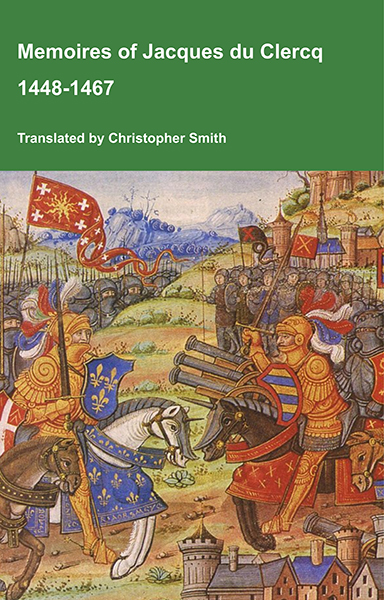
This is a translation of the 'Memoires of Jacques du Clercq', published in 1823 in two volumes, edited by Frederic, Baron de Reissenberg. In his introduction Reissenberg writes: 'Jacques du Clercq tells us that he was born in 1424, and that he was a licentiate in law and a counsellor to Philip the Good, Duke of Burgundy, in the castellany of Douai, Lille, and Orchies. It appears that he established his residence at Arras. In 1446, he married the daughter of Baldwin de la Lacherie, a gentleman who lived in Lille. We read in the fifth book of his Memoirs that his father, also named Jacques du Clercq, had married a lady of the Le Camelin family, from Compiègne. His ancestors, always attached to the counts of Flanders, had constantly served them, whether in their councils or in their armies.' The Memoires cover a period of nineteen years beginning in in 1448, ending in in 1467. It appears that the author had intended to extend the Memoirs beyond that date; no doubt illness or death prevented him from carrying out this plan. As Reissenberg writes the 'merit of this work lies in the simplicity of its narrative, in its tone of good faith, and in a certain air of frankness which naturally wins the reader’s confidence.' Du Clercq ranges from events of national and international importance, including events of the Wars of the Roses in England, to simple, everyday local events such as marriages, robberies, murders, trials and deaths, including that of his own father in Book 5; one of his last entries.
Available at Amazon in eBook and Paperback format.
Wiltshire Archaeological Magazine 1885 V22 Pages 345-348. Barrow at Ogbourne St Andrew's. Wilts [Map] by Mr. Cunnington, F.G.S.