Text this colour is a link for Members only. Support us by becoming a Member for only £3 a month by joining our 'Buy Me A Coffee page'; Membership gives you access to all content and removes ads.
Text this colour links to Pages. Text this colour links to Family Trees. Place the mouse over images to see a larger image. Click on paintings to see the painter's Biography Page. Mouse over links for a preview. Move the mouse off the painting or link to close the popup.

All About History Books
The Deeds of King Henry V, or in Latin Henrici Quinti, Angliæ Regis, Gesta, is a first-hand account of the Agincourt Campaign, and subsequent events to his death in 1422. The author of the first part was a Chaplain in King Henry's retinue who was present from King Henry's departure at Southampton in 1415, at the siege of Harfleur, the battle of Agincourt, and the celebrations on King Henry's return to London. The second part, by another writer, relates the events that took place including the negotiations at Troye, Henry's marriage and his death in 1422.
Available at Amazon as eBook or Paperback.
Journal of the Kilkenny and South-East of Ireland Archaeological Society is in Prehistory.
Books, Prehistory, Journal of the Kilkenny and South-East of Ireland Archaeological Society Volume 5 1866
Books, Prehistory, Journal of the Kilkenny and South-East of Ireland Archaeological Society Volume 5 1866 Pages 476-482
On Cromleacs near Tramore in the county of Waterford; with remarks on the classification of ancient Irish earthen and megalithic structures.
By George V. du Noyer, F. R. G. S. I., M. R. I. A., Geologist, Geological Survey of Ireland.
What is a Cromleac ? If I was asked this question by a critical antiquary, I could not answer it to his satisfaction, nor could he to my own. This is obviously a defect in our archaeological nomenclature, and the following remarks are offered with a view to arrive at some definite ideas on this subject.
In such an inquiry as this, the primary consideration should be the form, and mode of construction, of the stone chamber.
If we refer to some of our best authorities for information on this subject, we find the following statement by the well-known Danish archaeologist, Mr. Worsaae, in his work on Danish Prehistoric Antiquities (translated by W. J. Thorns, 1849):
"Stone chambers, or cromleacs, or low barrows encircled with stones, which completely accord with the cromleacs of our Stone Period, occur over the whole of Northern Germany, England, Ireland, the northern parts of Holland, and the west and south of France."
Here the stone chamber is called "a cromleac," no matter what its form, and the low barrow is considered to be an essential ingredient of the perfected structure, and our ideas thus become perplexed, rather than enlightened, on this particular class of antiquities.
Some antiquaries of note have, however, adopted this definition of a cromleac, as we find in the essay "On the Comparison of Danish Cromleacs with those of Britanny, the Channel Islands, and Great Britain, by the Rev. W. C Lukis, M. A., F. S. A.," read before the Wiltshire Archaeological and Natural History Society, in August, 1861. In this admirable memoir the author is disposed to adopt Mr. Worsaae's definition of a cromleac, as a tumulus enclosing a chamber formed of large stones placed one upon the other, and surrounded by a circle of upright stones at the base of the mound. At pages 164 and 165, Mr. Lukis admits that a deal of confusion has arisen "from the want of a proper generally recognised nomenclature amongst European antiquaries," as explanatory of the various kinds of early megalithic remains ; and he would have no objection to get rid of the word "cromleac," at the same time not offering us another name to supply its place.
For my part, I cannot see what valid objection there can be to the name cromleac ; and I believe it is now so well established that we must retain it, and that we can do so with every propriety.
In the year 1857 Sir William Wilde, M. D., in the first volume of the "Catalogue of the Museum of the Royal Irish Academy," at page 180, when referring to the various objects of antiquity found in the sepulchral chamber discovered in the low tumulus on Knockmaroon Hill, in the Phoenix Park,1 remarks that "this discovery went far to establish the belief that cromleacs were but uncovered tumuli, which originally contained sepulchral remains." This statement is even more vague than that of Mr. Worsaae, whose ideas on the subject it partially embodies. From this it would appear that to constitute a " cromleac" the tumulus must be "uncovered" (by which I suppose is meant "removed") from off the inner chamber (if there happened to be one), which chamber, when uncovered, then becomes a cromleac. We certainly want something more precise than this.
Note 1. A corruption of 'feenisk' which means clear or limpid water. See essay " On the Corruptions in Irish Topographical Names," by Patrick W. Joyce, A.M., " Proceedings of the Royal Irish Academy," vol. ix., part 3,
Sir Gardiner Wilkinson, in his memoir upon British Remains on Dartmoor, accepts the word "cromleac;" and though the name may not date back further than the sixteenth century, and its etymology is unknown, unless it be a compound of the Irish words cpom, bowed or bending, and leac, a stone, it will answer all the purposes intended, if applied to one particular kind of rude stone structure, and not made to do duty for a whole group of them.
Colonel Meadows Taylor, in his singularly interesting memoir on the Cairns, Kistvaens, and Cromleacs, and other Celtic, Druidical, or Scythian Monuments in the Dekhan, published in the "Transactions of the Royal Irish Academy," vol. xxiv., part 5, 1865, adopts the word cromleac, and thus defines it: "A rectangular structure, formed of three slabs of stone, and roofed with a horizontal slab, the whole above ground, and open at one side;" while he defines a kistvaen, or stone box, as "a chamber formed of four slabs, and covered by a horizontal slab, whether, it has been constructed above ground, or covered by a tumulus." These definitions of the two structures explain clearly the precise difference between them, and they very nearly apply to such remains existing in Europe.
In the "Essai sur les Dolmens," by the Baron de Bonstetten, of Geneva, that learned antiquary classifies the European megalithic structures into two classes: I. "Dolmens apparentes ;" II. " Dolmens couvert d' un tumulus en terre ou en cailloux." The first class includes the following ten varieties:
1. "Dolmens a dalle tombale, ce'st a dire une ou plusieurs dalles posees a plat sur le sol, entre des supports.
2. DolmensSans dalle tombale.
3. Dolmens a enceinte de pierres dressees (menhirs).
4. Dolmens sans enceinte de menhirs [maen-hir, long or upright stone]*
5. Dolmens a compartiments interieurs.
6. Dolmens simples [rectangular cist with covering slab].
7. Dolmens sur un tertre (tumulus).
8. Dolmenssur le sol naturel.
9. Dolmens supports dresses en hauteur.
10. Dolmens supports dresses en longeur."
All About History Books
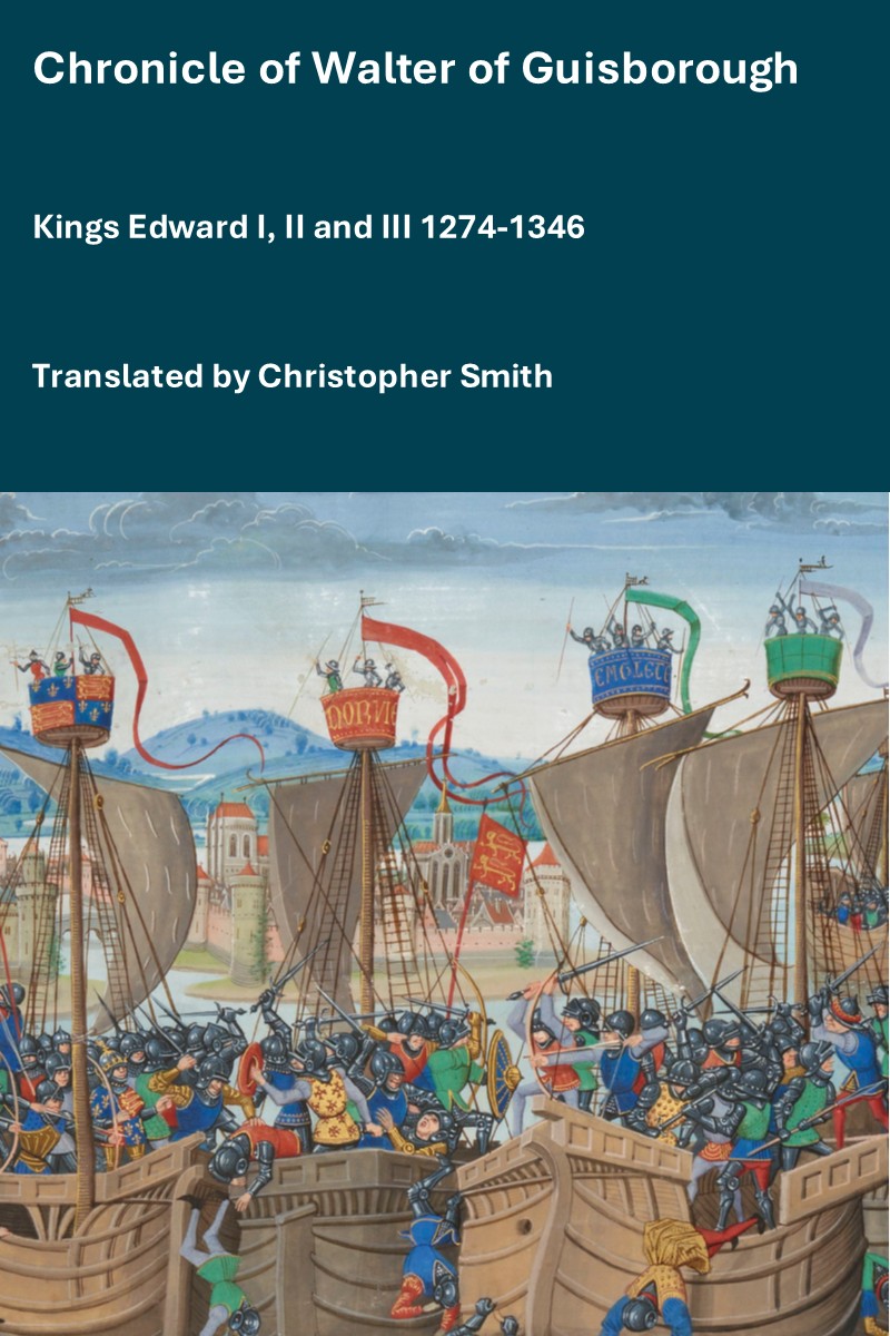
The Chronicle of Walter of Guisborough, a canon regular of the Augustinian Guisborough Priory, Yorkshire, formerly known as The Chronicle of Walter of Hemingburgh, describes the period from 1066 to 1346. Before 1274 the Chronicle is based on other works. Thereafter, the Chronicle is original, and a remarkable source for the events of the time. This book provides a translation of the Chronicle from that date. The Latin source for our translation is the 1849 work edited by Hans Claude Hamilton. Hamilton, in his preface, says: "In the present work we behold perhaps one of the finest samples of our early chronicles, both as regards the value of the events recorded, and the correctness with which they are detailed; Nor will the pleasing style of composition be lightly passed over by those capable of seeing reflected from it the tokens of a vigorous and cultivated mind, and a favourable specimen of the learning and taste of the age in which it was framed." Available at Amazon in eBook and Paperback.
The second class includes the following seven varieties:
1. "Dolmens a corridor et a, chambre avec compartiments.
2. Dolmens corridor et chambre.
3. Dolmens simples.
4. Dolmens a dalles tombales.
5. Dolmens sans dalles tombales.
6. Dolmens a enceints de menhirs.
7. Dolmens sans enceinte."
So far this is clear, and sufficiently comprehensive; and it would appear that the simple dolmen would most nearly resemble one of our cromleacs.
Sir Gardiner Wilkinson, in his memoir noted above, thus classifies the ancient British remains:
1. "The sacred circle.
2. The circle cairn, and concentric circle.
3. The barrow or tumulus (the Celtic 'crug' or mound, and the Saxon ' low').
4. The kistvaen, or stone box.
5. The avenue, or parallelithon.
6. The cromleac.
7. The maenhir, or long (upright) stone.
8. The tolmen, or maen-an-tol (holed stone).
9. The logan, or rocking stone.
10. The rock idol.
11. The rock basin (Irish bullaunf).
12. The markings and concentric rings on stones.
13. The hut circle, domed or beehive hut.
14. The walled village, or pound.
15. The boundary line.
16. Roads.
17. Bridges.
18. Camps."
Here we have the cromleac, as distinct from the kistvaen or stone box constructed below the soil, or enveloped in a mound ; and the two structures need never be confounded. At page 49 it is stated that the sepulchral chamber is not properly a cromleac, and to this I cordially agree.
If we now confine ourselves to the classification of those Pagan or early Christian structures, earthen or stone, or both combined, sepulchral or otherwise, preserved in Ireland, they are capable of being grouped as follows:
1. The stone circle.
2. The menhir, or standing stone, or gallaun.
3. The barrow, or simple earthen tumulus.
4. The chambered barrow, with surrounding circle of stones.
5. The ringed barrow, surrounded by one or more fosses and mounds.
6. The ringed and platformed barrow, or barrow with flat raised platform attached, the whole surrounded by one or more fosses and mounds.
7. The rath, or earthen circular rampart, surrounded by one or more fosses and mounds, the inner face of the central circle, and ocasionally those of the concentric ramparts, being sometimes faced with stone, in which case the term rath-caher may be applied.
8. The rectangular rath, with single surrounding fosse.
9. The cairn, or mound of broken stones.
10. The chambered cairn, with a surrounding row of flags.
The kistvaen, or stone box — a rude rectangular stone cham ber of four or many more stones covered with flat flags, and constructed either below or on the soil, or covered with a mound of clay and stones ; these are called by the peasantry "leabas," or "beds," "ti," or "house," a term which is seldom applied to the cromleac proper. In some instances the kistvaen is formed by a double row of upright flags.
12. The cromleac, or large block of stone poised in an inclined position on four or more upright blocks, thus forming a rude chamber usually open at one end, and sometimes divided internally by a single upright slab ; the whole bearing evidence of having been constructed on the surface, and never having been enclosed in a mound.
13. The caher, or caissel — a circular enclosure, formed entirely of massive dry masonry, the wall being pierced with a passage allowing access to the interior, and in most instances having had flights of steps leading to a parapet.
14. The cloghaun, or beehive-shaped stone hut, circular or rectangular in plan, either single, or with two or three chambers connected by narrow passages, and formed beneath an equal number of connected domes.1
15. The cnocãn, or stone hut, beehive-shaped, and either circular or angular in plan, the whole covered by a thick wall of earth.
16. The foslea, or long rectangular and narrow cell, formed of upright flags, and covered with horizontal flags.
17. The tolmen, or holed stone.
18. The rock basin, or bullaun.
19. The sepulchral dome-shaped chamber, formed of stone, either singly or in groups of three or more, ranged round a central chamber, the whole enclosed in a mound of broken stones and earth, and having a narrow entrance passage from the exterior of the mound.
20. The burrow, or subterranean dome-shaped chamber, single or compound : when the latter, one chamber is connected with another by a low narrow passage ; sometimes the burrow is constructed in the centre of a rath, and sometimes in the open country.
Note 1. See paper by the writer on the ancient Celtic city of Fahan, Ventry, county of Kerry, "Journal of the Archaeological Institute of Great Britain," vol. for 1858.
We may thus classify some of our most well marked Pagan or early Christian remains ; for those structures of the cloghaun type may really be comparatively recent, and it is evident that the cromleac occupies a very distinct position amongst them.
The primary consideration in this inquiry is the form and mode of construction of the cromleac, as distinct from the kistvaen, or true sepulchral chamber, no matter what its form. It is quite possible that the cromleac, as I propose to define it, was not the absolute burying place or tomb, but was the commemorative mausoleum, as it were, of the tribe, or its most distinguished family or person. So far as my information goes, I have never heard or read of any sepulchral remains having been found beneath the covering slab of a cromleac, as I understand the term; and as yet we have, I believe, no instance of a true cromleac having been exhumed from a mound of earth or stones. Chambers' covered with flat flags have been thus found, but all tradition, and the present appearance of the cromleac proper, assure us that they were ever in the same subaerial state as we now see them. I believe that the stone-covered single chambers which have been found in the centre of some tumuli' would not in their mode of construction fulfil the conditions necessary to make a cromleac, according to my interpretation of the word.
The somewhat remarkable cromleacs which form the subject of this paper are not only highly characteristic of their class, but they present some marked and novel features, which up to the present, I believe, have not been described. I allude to the fact that the two outermost upright supporting stones have a transverse stone like a diaphragm between them, very nearly equal to them in height, and which thus closes-in half of the structure, giving it a kistvaen character in plan, while in two instances the large table or covering stone rests at its depressed end on a smaller horizontal slab.

The illustration, Plate I, representing the cromleac in the townland of Knockeen [Knockeen Portal Tomb [Map]], at S. E. corner of the termon wall of the old church (near Sporthouse), Co. Waterford, affords an example of the two peculiarities alluded to ; and the whole structure is remarkable for its solidity, and the perfect carrying out of a unity of design.
The orientation of this structure is N. W. and S. E. ; the open end, or that presented to the view in the engraving, being that facing to the N. W.
The upright supporting stones are six in number, and are arranged rectangularly, so as to form a distinct chamber at the S. E. end, measuring 7x4 feet, by 6 feet 6 inches in height ; the side stones at the N. W. end projecting beyond the transverse or diaphragm stone a distance of 3 feet 6 inches.
The large covering slab measures 12 feet 6 inches x 8 feet, with an average thickness of 1 foot 6 inches, thus giving a weight of something like 4 tons ; the supplemental covering stone measuring 7 feet x 8 feet.
The height of the supporting stone nearest in the view is 8 feet 6 inches above the present level of the ground and the total height of the structure to the top surface of the large covering slab is 12 feet 6 inches : at the open or N. W. end the supporting stones are 3 feet 3 inches apart. The blocks are formed of the rudely cleaved felspathic dark grey trap of the district.

The illustration, Plate II, is that of the cromleac in the townland of Gauls town [Gaulstown Portal Tomb [Map]], in the same county, on the northern flank of Carrick-a-roirk Hill.1
Here we have a structure very similar to the former in general design, though different from it in some details, viz. : — The absence of the lower and supplemental covering slab ; and the open end of the chamber facing to the S. of E., while the inner chamber is rudely hexagonal in plan, owing to the peculiar way in which the upright slabs have been arranged (see plan).
The inner chamber measures 7 feet x 6 feet 4 inches at its maximum width, having a height of 7 feet ; the diaphragm stone being 3 feet 3 inches wide ; the outer open space being 2 feet deep, and narrowing to 2 feet 6 inches at its external edge. The covering or table stone is 12 feet x 7 feet at its S. E. end, with an average thickness of one foot, which thus gives a weight of about 3 tons ; the height of the supporting stones at the E. S. E. or open end of the structure is about 8 feet 6 inches. These blocks, like those forming the other cromleac, have been derived from the local trappean rocks. At the distance of 31 feet N. W. from this cromleac there occurs a true kistaen, constructed in the soil ; this chamber is formed of several large slabs set on edge, and measures 1 6 feet or 1 7 feet in length, by about 4 feet 6 inches or 5 feet in width ; it was originally covered horizontally by three flags, one of which yet remains, and measures 8 feet x 5 feet 6 inches in width-.
Here we have clear evidence to show that the kistvaen was a structure very distinct from the cromleac.
Note 1. Anglice, the Rock of the Prospect.
The third example (Plates III, and IV.) I have tp offer is that of the cromleac in the townland of Ballynageeragh [Ballynageeragh Portal Tomb [Map]], county of Waterford, and not very distant from that last described.
This structure as viewed from the S. E. has a most singular appearance, owing to the form of the covering' stone, and the skilful manner in which it is poised on two supports ; that at the S. W. or raised end being an upright slab ; the other, to the N. E., being a rounded flat stone laid on the ends of the remaining three stones forming the chamber (see plan).
The large table stone measures 12 feet x 8 feet, with an average thickness of one foot, and may therefore be about 3 tons in weight ; and at its most elevated *or N. W. end it is 6 feet from the present level of the ground. The chamber beneath is simply rectangular in plan, the stones forming it being all inclined inwards, as shown in the view, looking N. E.


I by no means wish to take credit as being the first to suggest this mode of construction as applicable to our cromleacs, or other megalithic structures, where enormous blocks of stone have been left resting on vertical supports. The late King of Denmark, and for aught I know other antiquaries, have suggested the same theory, which would, I think, apply with equal force to such structures as Stonehenge. That such was the mode of construction actually adopted by the cromleac builders is, I think, almost proved by the fact that we occasionally find half-finished and abandoned cromleacs, as the rude mechanical appliances known to the builders were totally unequal to the completion of the work on the failure of their first rude attempt.
All About History Books
The Chronicle of Walter of Guisborough, a canon regular of the Augustinian Guisborough Priory, Yorkshire, formerly known as The Chronicle of Walter of Hemingburgh, describes the period from 1066 to 1346. Before 1274 the Chronicle is based on other works. Thereafter, the Chronicle is original, and a remarkable source for the events of the time. This book provides a translation of the Chronicle from that date. The Latin source for our translation is the 1849 work edited by Hans Claude Hamilton. Hamilton, in his preface, says: "In the present work we behold perhaps one of the finest samples of our early chronicles, both as regards the value of the events recorded, and the correctness with which they are detailed; Nor will the pleasing style of composition be lightly passed over by those capable of seeing reflected from it the tokens of a vigorous and cultivated mind, and a favourable specimen of the learning and taste of the age in which it was framed." Available at Amazon in eBook and Paperback.
On the west side of the glen, just below Ballyphilip Bridge, county of Waterford, I found an enormous block of grit, one end of which rested on two low supporting stones, while the other was propped up by a wall of dry masonry 3 feet high ; in this instance we have an example of an unfinished and abandoned cromleac. 1 Another example of a defective and abandoned cromleac is to be seen in the demesne of Headford, near the gate lodge ; this consists of an angular block of grey Silurian grit, measuring 9 feet 6 inches x 6 feet x 3 feet 8 inches, the weight of which is fully 6 tons ; its eastern edge rests on the ground, while the western side is tilted up and supported by a single block of grit, measuring 3 feet in length by 1 foot 6 inches thick. Some blocks of rock lie near at hand, as if intended to have formed a portion of the structure ; it appears to me that, when the large table stone by some means or other failed to rest properly on its intended supports, the work was abandoned, and some other boulder stone in the neighbourhood selected for the purpose ; at all events, the structure is incomplete.
That the foregoing observations may be clearly understood, I would thus define a cromleac:
A megalithic chamber, usually rectangular and sometimes open at one end, formed of four or more upright slabs, on which is poised in a slanting position a large covering stone, the whole structure resting on the natural soil, and presenting no indications of having ever been enveloped in a mound or tumulus.
I cannot conclude these brief remarks better than by the following quotations — the first, a portion of the review in "The Athenæum" (21st of April, 1866) of Lieut.-Col. Forbes Leslie's work " On the Early Races of Scotland, and their Monuments," alluding to the so-called Druids' altar or cromleac, is as follows:
" The western maritime division of the Continent of Europe presents vast aggregations of them in various localities, and they are found extending across the Mediterranean, and occupying a wide field in Africa. Recent exploration has traced them over Tartary, and as far as the Chinese frontier, and into the centre of the Peninsula of India. Iranian and Turanian, Caucasian and Semitic, Hamite and Allophyllian, Celtic and Gothic waves of population have swept over the portions of the area which the structures occupy; but there remains no distinct record of any monument of this class except in the Old Testament.
" These people were neither Druids, nor Phoenicians, nor Gauls, nor Celts who set up these monuments, but a people who once existed all over Europe, Asia and parts of Africa, and whose usages had passed away before any history but that of the Hebrews began.
"On the other hand, the low-age school of speculation puts Stonehenge within the fifth century of the Christian era, and brings down the use of the stone table as a sepulchral monument to a time when the capitals of columns had already begun to display the characteristic forms known in architecture as early English."
The truth of these remarks few will question ; and the pleasing fallacy of trying to speculate on the age of such works as evinced by their mode of construction, or the rude devices with which they are occasionally decorated, is admirably exposed by the following remarks ofPalgrave, in his "History of Normandy and England," vol. i., p. 49:
"Celtic history ... has been rendered the meaningless vacuity of literature by the unbounded speculations of the learned. When will archaeologists be convinced that men-hir and pul-ven, cromleac and kistvaen tell us nothing? and from nothing, nothing comes. You can no more judge of their age than the eye estimate the height of the clouds. These shapeless masses impart but one lesson — the impossibility of recovering by induction any knowledge of the speechless past."
So far as our present information leads us, we must believe that the cromleac builders, and the constructors of the chambered cairns, and other megalithic structures, were of a race most widespread over the northern hemisphere wherever it was habitable — that we have lost all record of the locality from whence that race originally sprang, of their name, or their language — and that the present races, who possibly exterminated them, were themselves so rude and unlettered, that they had not the intelligence to transmit to their descendants the traditional history of the people they dispossessed.
Books, Prehistory, Journal of the Kilkenny and South-East of Ireland Archaeological Society Volume 5 1866 Pages 497-501

Remarks on a Kistvaen, and on some carvings on an "earth-fast" rock, in the County of Louth. By George V. Du Noyer, M. R. I. A.
At the northern end of the parish of Monasterboice, and at the distance of about three miles east of Collon, in the county of Louth, there is a large Kistvaen, in a remarkably good state of preservation, called Calliagh Dirra's House [Map]. It stands on the line of an apparently old wall fence; and it is exceedingly interesting, as tending to aid in illustrating my remarks on the classification of ancient megalithic structures published in the last number of our Journal.
This grave, "House," or "Bed," as such remains are frequently called, measures internally 12 feet 8 inches in length, by 3 feet in width at its western, and 4 feet at its eastern end. In it we have a typical example of the true Kistvaen, as distinct from the true Cromleac ; its form (see Plate I.), is rectangular, and its orientation due east and west ; five large flagstones placed on edge form its southern side, with a supplemental stone at the exterior of the last flag at the S. W. angle of the structure ; five other flags form the northern side, which is not equal in length to the southern, the difference being intended to be made up by the flag at the east end, which closed up the Kist; a large supplemental supporting stone rests against the third and fourth flags on the northern side, as shown in the view and plan of the chamber ; the west end is blocked up by one large flag ; and that which closed the east end is now lying on the ground. The whole structure is covered by four large flags. Along the southern side the three most westerly flags are supported externally by five small low blocks, securely set in the ground, like stunted buttresses ; and it is possible that similar supports were originally placed around the structure ; the whole of which, judging from analogy, must have been originally enveloped in a Tumulus.
My friend Mr. Eugene. A. Conwell, in his interesting account of his explorations of the ancient sepulchral Cairns on the Loughcrew Hills, county of Meath, published in the " Proceedings of the Koyal Irish Academy," vol. ix., part iv. (1867), quotes from a let* ter by the late Dr. O'Donovan (dated, Kells, July 30, 1836), wherein allusion is made to the celebrated hag of Irish lore called Callighe Bheartha (Callighe Vera), who gave her name (Slieve na Callighe) to the range of hills just alluded to. She is supposed to have been burried near this in the parish of Diamor, in a field called Cul d rtioca (i. e. back of the moat). Subsequent research, however, led to the identification of the Kistvaen which I have now illustrated, from the parish of Monasterboice, as being the true grave or " House" of Callighe Vera; but the local pronunciation of the word has been retained on the Ordnance Survey Map, County Louth, Sheet No. 21.
Since compiling my remarks on the classification of ancient Irish megalithic structures, published in the Journal, No. 52, April, 1866, I have looked further into the subject, and find that it has developed itself on several important points: First, with regard to the Kistvaens or true graves ; they are of three varieties, and are capable of being thus classified:
1st. The Leacht, or simple rectangular chamber formed of four stones, and covered by a single flag, like those so-called Cromleacs so common over the Burren country in the county of Clare;
2nd. The Kistvaen, or Cistfaen, the long rectangular chamber formed of many stones, and flagged overhead, like that which forms the subject of this notice.
3rd. The Cnocan Cist (as it might be called), or long rectangular chamber, formed by a double row of upright slabs some feet apart, the intervening space being filled with earth, the covering slabs only reaching across the inner row of the side stones ; an example of which occurs on the northern slope of the hill to the south of Sporthouse, county of Waterford. It is quite possible that each of these structures represents a different age, which might synchronize with the order in which I have placed them.
With regard to the Cromleacs, it is a remarkable fact that close to very many of them a Kistvaen has been constructed ; and I go so far as to say that, if we had accurate records of what took place close around our existing true Cromleacs with reference to farming or such like operations during the last century or so, we would find that each Cromleac had its attendant Kistvaen, or grave — not that I ever regarded the Cromleac as a "sacrificial altar;" but I believe that it was not the grave proper, but rather the commemorative sub-aerial structure to mark the site and fact of the interment either of a king or of a race.
The Cromleacs that I know of to which a Kistvaen is associated are those of Gallstown, county of Waterford; Moun thrown, county of Carlow; Mountvenus, county of Dublin. The Cromleac north of Dundalk, and that on top of Coolrus Hill, Queen's County, 1 and doubtless many other similar examples, could be brought forward. Moreover, I believe I can show that we possess two distinct varieties of Cromleac ; but this point I shall reserve for the subject of a future notice.

At the distance of 350 yards to the N. W. of the Kistvaen called " Calliagh Dirra's House," I was fortunate enough, in the month of September, 1866, to discover some remarkable markings, "Graffiti," produced by scraping and punching (see Plate II.) on an "earth-fast," or natural rock surface of grey calcareous grit. Some of these devices are different from those on a similar rock at Ryefield, county of Cavan, which I described and figured in a previous number of this Journal, and they thus add to our information on this singularly interesting subject.
All About History Books
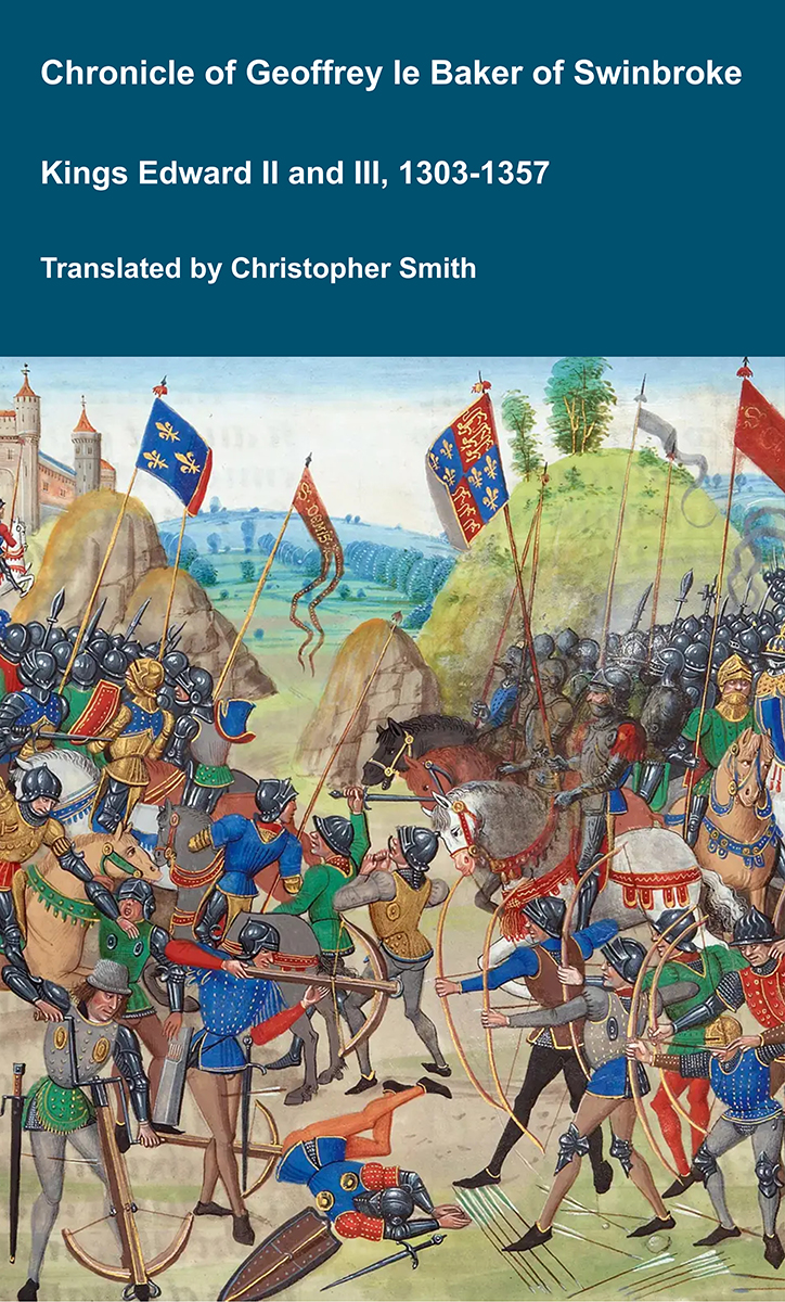
The Chronicle of Geoffrey le Baker of Swinbroke. Baker was a secular clerk from Swinbroke, now Swinbrook, an Oxfordshire village two miles east of Burford. His Chronicle describes the events of the period 1303-1356: Gaveston, Bannockburn, Boroughbridge, the murder of King Edward II, the Scottish Wars, Sluys, Crécy, the Black Death, Winchelsea and Poitiers. To quote Herbert Bruce 'it possesses a vigorous and characteristic style, and its value for particular events between 1303 and 1356 has been recognised by its editor and by subsequent writers'. The book provides remarkable detail about the events it describes. Baker's text has been augmented with hundreds of notes, including extracts from other contemporary chronicles, such as the Annales Londonienses, Annales Paulini, Murimuth, Lanercost, Avesbury, Guisborough and Froissart to enrich the reader's understanding. The translation takes as its source the 'Chronicon Galfridi le Baker de Swynebroke' published in 1889, edited by Edward Maunde Thompson. Available at Amazon in eBook and Paperback.
That these markings are of the remotest antiquity I have not the least doubt, as they are covered by a thick coating of lichen, and some them are of quite a Rhunic character. It is true that two of these devices, which are close to one another, resemble the Roman letters P, I, yet this resemblance is no doubt accidental ; just as some of the devices from the megalithic chambers of Slieve-naCallighe and also those on some of the carved rocks in Sweden, closely resemble a pair of spectacles — O^O ; yet no one for a mument could think that they had such a significance, though they possibly may be typical of the human face.1
Note 1. See Worsaae, and the Memoir on the Caves of Chaffaud (dePoitou), by MM. Brouillett and Meillett, with illustrations of the carved bones discovered in the stalagmite of the caves.
The most remarkable of the devices on this rock may be described as a cross of eight arms, resting on a short flat pedestal. If this latter feature was removed, we have a close resemblance to the Runic letter H ; the mark which resembles the letter P is very similar to the rune of the same significance ; and the small simple cross, the upright arm being the longer, is quite like the Runic letter E.1
Note 1. 2 See Wilson's "Prehistoric Annals of Scotland," and the last volume of the Spalding Club, where the cross of eight arms precisely the same as now figured is found on the rock at "Jonathan’s Cave," East Wemyss, Forfarshire.
I have every reason to think that future explorers will show that we have true Runic inscriptions in Ireland; but as yet we have not accumulated sufficient data to enable us to speculate with any probability of arriving at the true date, history, or character of such ancient rock carvings as these. There cannot be a doubt as to their great antiquity ; and I believe that they point to that one primitive race which overspread the northern hemisphere long before the formation of the present tribes and mixed races which now inhabit it.
I may, perhaps, be permitted to remark that I have long advocated the theory of the unity of race of that people who carved the rude devices on our «' earth-fast" rocks, and constructed our Cromleacs and megalithic structures ; and I am gratified to find my views on this subject most markedly corroborated by that distinguished ethnologist, Professor Rutimeyer, of Basle.
I shall close these few remarks by quoting the words of this savant, as given in the results of his investigations of the animal remains from the now submerged lake dwellings in Switzerland:
"I cannot refrain from expressing my conviction that even the oldest hike dwellings do not by any means exhibit to us the primitive population of our country . . For my own part, therefore, I have little doubt of the existence, at one time, of a genuine primitive population throughout Europe. This appears to have been proved, as far as France is concerned, by the latest discoveries at Aurignac.1 This seems to be the first place where we can no longer strive against the evidence of a European population who used as food, not only the urus and the bison, but also the mammoth and the rhinoceros ; and who left the remains of their feasts, not only to be gnawed by the wolf and the fox, but also by the tiger and the hyena
"The discovery at Aurignac places the age of our lake dwellings at a comparatively late period, although almost immediately under our peat beds, with their rich treasures, similar antiquities are found ; nay, still older remains are met with only a little deeper (in the slaty brown- coal of Durnten, perhaps forty feet under the bed of the Lake Pfaffikon) than those of Aurignac, which have there been gnawed by hyenas, after having been despoiled of their marrow (like the bones at Kobenhausen) by human hands.
"This last fact would also point out to us the place where we have to look for the remains of the ancestors of the lake settlers, namely, under the glacial moraines; for it is manifest that the people who inhabited the Grotto of Aurignac were older than the extension of the glaciers, and consequently also witnesses of this mighty phenomenon At all events, the last gap between geological and historical time is now filled up by the discovery at Aurignac."2
Note 1. See the "Société Philomathique de Paris, extrait de la Séance du 18 Mai, 1861.
Note 2. See "Lake Dwellings of Switzerland and other Parts of Europe, by Dr. Ferdinand Kellor, translated by John Edward Lee, F. S. A. :" London, 1860, pp. 359, 360.