Chronicle of Walter of Guisborough
A canon regular of the Augustinian Guisborough Priory, Yorkshire, formerly known as The Chronicle of Walter of Hemingburgh, describes the period from 1066 to 1346. Before 1274 the Chronicle is based on other works. Thereafter, the Chronicle is original, and a remarkable source for the events of the time. This book provides a translation of the Chronicle from that date. The Latin source for our translation is the 1849 work edited by Hans Claude Hamilton. Hamilton, in his preface, says: 'In the present work we behold perhaps one of the finest samples of our early chronicles, both as regards the value of the events recorded, and the correctness with which they are detailed; Nor will the pleasing style of composition be lightly passed over by those capable of seeing reflected from it the tokens of a vigorous and cultivated mind, and a favourable specimen of the learning and taste of the age in which it was framed.'
Available at Amazon in eBook and Paperback format.
Orkney is in Orkney Islands.
Carbon Date. 1627BC. Middle Bronze Age Carbon Dates
Report: Bone and teeth, id as animal, in rubble infill of cooking trough of secondary structure at Beaquoy, Orkney [Map], Scotland. Comment [Ed]: some TL dates also available: see second ref below.
ID: 395, C14 ID: SRR-1001 Date BP: 3627 +/- 65, Start Date BP: 3562, End BP: 3692
OS Letter: HY, OS East: 301, OS North: 219
Archaeologist Name: J W Hedges
Reference Name: Renfrew C (ed), 'The prehistory of Orkney', 1985, 270; Proc Soc Antiq Scotl, 106, 1974-5, 39-98
Council for British Archaeology (2012) Archaeological Site Index to Radiocarbon Dates from Great Britain and Ireland [data-set]. York: Archaeology Data Service [distributor] https://doi.org/10.5284/1017767
Carbon Date. 461BC. Middle Iron Age Carbon Dates
Report: Wood, id as twigs, from silt at base of well-like structure relating to secondary structure at Beaquoy, Orkney [Map], Scotland.
ID: 396, C14 ID: SRR-999 Date BP: 2461 +/- 80, Start Date BP: 2381, End BP: 2541
OS Letter: HY, OS East: 301, OS North: 219
Archaeologist Name: J W Hedges
Reference Name: Renfrew C (ed), 'The prehistory of Orkney', 1985, 270; Proc Soc Antiq Scotl, 106, 1974-5, 39-98
Council for British Archaeology (2012) Archaeological Site Index to Radiocarbon Dates from Great Britain and Ireland [data-set]. York: Archaeology Data Service [distributor] https://doi.org/10.5284/1017767
Carbon Date. 1260BC. Late Bronze Age Carbon Dates
Report: Carbonised seed from midden material adjacent to F T Wainwright excavation 1960 (cuttings 5/6) at Birsay [Map], 2 Brough Rd, Area 6, Orkney, Scotland.
ID: 407, C14 ID: GU-1222 Date BP: 3260 +/- 180, Start Date BP: 3080, End BP: 3440
OS Letter: HY, OS East: 244, OS North: 281
Archaeologist Name: C D Morris
Reference Name: Univ Durham/ Univ Newcastle upon Tyne Archaeol Rep for 1980 (1981), 38; Morris C D, 'The Birsay Bay Project (1)', 1989, 298-9
Council for British Archaeology (2012) Archaeological Site Index to Radiocarbon Dates from Great Britain and Ireland [data-set]. York: Archaeology Data Service [distributor] https://doi.org/10.5284/1017767
Carbon Date. 1060. Late Medieval
Report: Carbonised plant material from midden-like layer of rectangular building at Birsay Beachview (Studio site), Orkney, Scotland. Comment [Ed]: Date lies within Norse period.
ID: 323, C14 ID: GU-1191 Date BP: 940 +/- 55, Start Date BP: 885, End BP: 995
OS Letter: HY, OS East: 247, OS North: 275
Archaeologist Name: C D Morris, N Emery
Reference Name: Univ Durham/Univ Newcastle-upon-Tyne Archaeol Rep for 1979, 29; Discovery Excav Scot for 1979, 22
Council for British Archaeology (2012) Archaeological Site Index to Radiocarbon Dates from Great Britain and Ireland [data-set]. York: Archaeology Data Service [distributor] https://doi.org/10.5284/1017767
Carbon Date. 780. Early Medieval
Report: Bone, id as mammal (ox, sheep, pig) (id. D J Rackham), from enclosure, Phase B1-2, DS76C1 at Brough of Deerness [Map], Orkney, Scotland.
ID: 1856, C14 ID: GU-1558 Date BP: 1220 +/- 90, Start Date BP: 1130, End BP: 1310
OS Letter: HY, OS East: 596, OS North: 87
Archaeologist Name: C D Morris
Reference Name: Proc Soc Antiq Scotl, 116, 1986, 307-74
Council for British Archaeology (2012) Archaeological Site Index to Radiocarbon Dates from Great Britain and Ireland [data-set]. York: Archaeology Data Service [distributor] https://doi.org/10.5284/1017767
Carbon Date. 1080. Late Medieval
Report: Bone, id as human (id. D J Rackham and S W Hillson), from enclosure, Phase C2, DS76BS, slab-covered grave at Brough of Deerness [Map], Orkney, Scotland.
ID: 1858, C14 ID: GU-1574 Date BP: 920 +/- 65, Start Date BP: 855, End BP: 985
OS Letter: HY, OS East: 596, OS North: 87
Archaeologist Name: C D Morris
Reference Name: Proc Soc Antiq Scotl, 116, 1986, 307-74
Council for British Archaeology (2012) Archaeological Site Index to Radiocarbon Dates from Great Britain and Ireland [data-set]. York: Archaeology Data Service [distributor] https://doi.org/10.5284/1017767
Cuween Chambered Cairn is also in Maeshowe Type Chambered Cairn.
Cuween Chambered Cairn [Map] is a Maeshowe Type Chambered Cairn on the main island of Orkney similar to Maeshowe Chambered Cairn [Map] albeit smaller.
Carbon Date. 1135. Late Medieval
Report: Human bone from cist - no grave goods at Sand Side, Graemsay, Orkney, Scotland.
ID: 208, C14 ID: GU-1067 Date BP: 865 +/- 55, Start Date BP: 810, End BP: 920
OS Letter: HY, OS East: 265, OS North: 60
Archaeologist Name: J W Hedges
Reference Name: Proc Soc Antiq Scot, 109, 1977-8 (1980), 374-8
Council for British Archaeology (2012) Archaeological Site Index to Radiocarbon Dates from Great Britain and Ireland [data-set]. York: Archaeology Data Service [distributor] https://doi.org/10.5284/1017767
On 12th November 1649 Robert Douglas 8th Earl Morton [aged 33] died at Kirkwall. His son William succeeded 9th Earl Morton.
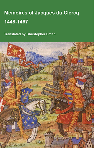
This is a translation of the 'Memoires of Jacques du Clercq', published in 1823 in two volumes, edited by Frederic, Baron de Reissenberg. In his introduction Reissenberg writes: 'Jacques du Clercq tells us that he was born in 1424, and that he was a licentiate in law and a counsellor to Philip the Good, Duke of Burgundy, in the castellany of Douai, Lille, and Orchies. It appears that he established his residence at Arras. In 1446, he married the daughter of Baldwin de la Lacherie, a gentleman who lived in Lille. We read in the fifth book of his Memoirs that his father, also named Jacques du Clercq, had married a lady of the Le Camelin family, from Compiègne. His ancestors, always attached to the counts of Flanders, had constantly served them, whether in their councils or in their armies.' The Memoires cover a period of nineteen years beginning in in 1448, ending in in 1467. It appears that the author had intended to extend the Memoirs beyond that date; no doubt illness or death prevented him from carrying out this plan. As Reissenberg writes the 'merit of this work lies in the simplicity of its narrative, in its tone of good faith, and in a certain air of frankness which naturally wins the reader’s confidence.' Du Clercq ranges from events of national and international importance, including events of the Wars of the Roses in England, to simple, everyday local events such as marriages, robberies, murders, trials and deaths, including that of his own father in Book 5; one of his last entries.
Available at Amazon in eBook and Paperback format.
On 21st August 1557 Admiral John Clere [aged 46] drowned with around ninety of his men whilst attempting to storm the Bishop's Palace, Kirkwall.
Carbon Date. 1585BC. Middle Bronze Age Carbon Dates
Report: Antler mattock, id as Cervus elaphus, UPM/IV.3, from a burial cist at Crantit Farm, Kirkwall, Orkney, off Scotland. Subm C Bonsall and C Tolan-Smith. Comment (subm): sample (once mistakenly reported as from Cnoc Sligeach on Oronsay) dates to Bronze Age, confirming its context.
ID: 7607, C14 ID: OxA-4607 Date BP: 3585 +/- 55, Start Date BP: 3530, End BP: 3640
Abstract: Mesolithic artefact dating programme
Archaeologist Name: C Bonsall and C Tolan-Smith
Reference Name: Archaeometry, 40, 1998, 441; Proc Soc Antiq Scotl, 89, 1955-6, 91-106; Meso Miscellany, 16(1), 1995, 11-16
Council for British Archaeology (2012) Archaeological Site Index to Radiocarbon Dates from Great Britain and Ireland [data-set]. York: Archaeology Data Service [distributor] https://doi.org/10.5284/1017767
Wideford Hill Chambered Cairn is also in Maeshowe Type Chambered Cairn.
2000BC. Wideford Hill Chambered Cairn [Map] is a Neolithic chambered cairn on Mainland, Orkney in Scotland. The tomb dates to around 2000 BC, and is similar in design to the Maeshowe chambered cairn [Map] on Orkney.

Chapter IV Dwellings. In the month of October 1849, Mr. Petrie's attention was directed to a large tumulus or green knoll, which stands about half-way up the western declivity of Wideford-hill [Map], overlooking the beautiful bay of Firth on the mainland of Orkney, and within a short distance of the Pict's house of Quanterness, described in Barry's History of Orkney. Being on a steep and unfrequented part of the hill, it appears to have almost entirely escaped observation. An opening, however, had been attempted at some former period, but abandoned after an excavation of about a couple of feet in depth had been effected. Mr. Petrie employed men to make a section into the mound, and himself superintended and assisted in the operation, which proved one of considerable time and labour, from the large stones and the quantity of clay used in completing the external mound, as well as in the masonry of the structure found underneath. The building appears to have been con- structed in the following manner: — A place for the site having been scooped out of the side of the hill, the cells or apartments were built of large uneven stones, the walls being made gradually to converge as they rose in height, until they approached to within a foot at top. Externally the work was bounded by a wall of about two feet high. The entire structure was then brought to a conical shape with stones and clay; the stones being disposed with considerable regularity, and over all a thick layer of turf or peat had been laid. The mound which encloses the whole is about one hundred and forty feet in greatest circumference, and forty-live feet in diameter. The work of exploration was commenced by making a cut, six feet in breadth, upon the north side, and clearing away the stones and clay in the direction of the highest part of the mound. On penetrating towards the centre, at about six feet from the top, a stone was exposed placed on edge, about eighteen inches long and nine inches thick, underneath which lay another, which was found to cover a hole of about a foot square, at the top of the chamber marked D in the plan. (Plate I.) On obtaining entrance to this chamber or cell, it proved, like those subsequently opened, to be constructed with walls gradually converging on all sides towards the top, and to measure five feet nine inches in length from north to south, four feet eight inches in breadth, and five feet six inches in height. On the west side of the chamber, the small passage, marked h, was observed appearing to communicate with another apartment, but it was so blocked up with stones and rubbish, that excavation had to be resumed from the exterior. After working for upwards of an hour, the large stone, marked m, was reached, and on removing it an entrance was effected into the central chamber A. This was about three-fourths filled with stones and rubbish, heaped up under the opening marked i, on digging into which bones and teeth of the horse, cow, sheep, boar, &c., were discovered mixed with the rubbish, and also some which were supposed to be those of deer, but not a vestige of human bones.

Archaeological Journal Volume 20 Section III. These buildings are numerous in Orkney, and are generally in some prominent place, as the brow of a hill—the sea-side—an islet by the margin of a lake—or other similar locality. Human skeletons have been found in one or two of them, but it has generally been supposed that they had been deposited there long after the building had become ruinous. I found in the Picts'-house on Wideford-hill [Map], which was in excellent preservation, great quantities of the bones of horse, ox, swine, and sheep. The bones of the larger animals lay lowest amongst the stones and earth with which the central chamber was more than half filled. I selected a jaw-bone from a quantity of bones which lay in a passage leading from the central chamber to one of the cells, and sent it to Mr. Stuart, the secretary of the Society of Antiquaries in Edinburgh, by whom it was submitted to the late Professor Quekett of London, who pronounced it to be a relic of the species bos longifrons. The discovery of the remains of an animal which is believed to have become extinct in Britain about the time of the Roman invasion, shows the importance of preserving all animal remains which may be found in the aboriginal structures, and is at the same time an evidence of the antiquity of the buildings in which such remains are discovered. The bones were deposited in the mouths of the passages leading to the cells, as if the animals had been intended to be offerings to the deities, or to the manes of the departed. The accompanying plan and section of a Picts'-house in the Island of Eday [Vinquoy Chambered Cairn [Map]], which was opened in 1857 by Robert J. Hebden, Esq., of Eday, and James Farrer, Esq., M.P., will convey a general idea of those interesting structures. The following are the measurements of the various chambers in this Picts'-house;—
A. The central chamber, 6 ft 9 in. by 5 ft.; height 10 ft.
B. 5 ft. 6 in. by 2 ft. 3 in.; height 5 ft.; the length of the passage of approach to this chamber from the central one is about 3 ft. 6 in., its width about 1 ft. 9 in.
C. 5 ft. by 4 ft.; height 6 ft.; the width of the passage of approach, 1 ft. 3 in.
D. 4 ft. 6 in. by 3 ft.
E. 5 ft. 6 in. by 3 ft.
F. Entrance passage, 12 ft. in length, 1 ft. 8 in. in width, 3 ft. in height. It was continued beyond the encircling WALL, G G
Knowes of Quoyscottie, Orkney. Probable rubbish heaps, on the edge of an area of surface quarrying, lie east and west of each other, measuring 34ft by 28ft by 4ft high, and 30ft in diameter by 4ft 6ins in height respectively.
Carbon Date. 1145BC. Late Bronze Age Carbon Dates
Report: Charcoal, id as Corylus, from cremation F.103 at Knowes of Quoyscottie, Orkney, Scotland.
ID: 4524, C14 ID: UB-2161 Date BP: 3145 +/- 120, Start Date BP: 3025, End BP: 3265
Abstract: Small mounds
Archaeologist Name: M Hedges
Reference Name: Radiocarbon, 21, 1979, 275; Proc Soc Antiq Scot, 108, 1976-7 (1979), 150-1 [also gives further dates imprecisely cited: Ed]; C Renfrew, 'The prehistory of Orkney' (1985) (calibr and synthesis)
Council for British Archaeology (2012) Archaeological Site Index to Radiocarbon Dates from Great Britain and Ireland [data-set]. York: Archaeology Data Service [distributor] https://doi.org/10.5284/1017767
Carbon Date. 940BC. Early Iron Age Carbon Dates
Report: Charcoal, id as Corylus, from cremation F.64 at Knowes of Quoyscottie, Orkney, Scotland.
ID: 4525, C14 ID: UB-2162 Date BP: 2940 +/- 85, Start Date BP: 2855, End BP: 3025
Abstract: Small mounds
Archaeologist Name: M Hedges
Reference Name: Radiocarbon, 21, 1979, 275; Proc Soc Antiq Scot, 108, 1976-7 (1979), 150-1 [also gives further dates imprecisely cited: Ed]; C Renfrew, 'The prehistory of Orkney' (1985) (calibr and synthesis)
Council for British Archaeology (2012) Archaeological Site Index to Radiocarbon Dates from Great Britain and Ireland [data-set]. York: Archaeology Data Service [distributor] https://doi.org/10.5284/1017767
Carbon Date. 850BC. Early Iron Age Carbon Dates
Report: Charcoal, id as Betula, from cremation F.15 at Knowes of Quoyscottie, Orkney, Scotland.
ID: 4526, C14 ID: UB-2158 Date BP: 2850 +/- 40, Start Date BP: 2810, End BP: 2890
Abstract: Small mounds
Archaeologist Name: M Hedges
Reference Name: Radiocarbon, 21, 1979, 275; Proc Soc Antiq Scot, 108, 1976-7 (1979), 150-1 [also gives further dates imprecisely cited: Ed]; C Renfrew, 'The prehistory of Orkney' (1985) (calibr and synthesis)
Council for British Archaeology (2012) Archaeological Site Index to Radiocarbon Dates from Great Britain and Ireland [data-set]. York: Archaeology Data Service [distributor] https://doi.org/10.5284/1017767
Carbon Date. 660BC. Early Iron Age Carbon Dates
Report: Charcoal, id as Betula, from cremation F.91 at Knowes of Quoyscottie, Orkney, Scotland.
ID: 4527, C14 ID: UB-2163 Date BP: 2660 +/- 150, Start Date BP: 2510, End BP: 2810
Abstract: Small mounds
Archaeologist Name: M Hedges
Reference Name: Radiocarbon, 21, 1979, 275; Proc Soc Antiq Scot, 108, 1976-7 (1979) 150-1 [also gives further dates imprecisely cited: Ed]; C Renfrew, 'The prehistory of Orkney' (1985) (calibr and synthesis)
Council for British Archaeology (2012) Archaeological Site Index to Radiocarbon Dates from Great Britain and Ireland [data-set]. York: Archaeology Data Service [distributor] https://doi.org/10.5284/1017767
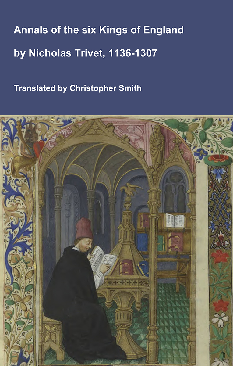
Annals of the six Kings of England by Nicholas Trivet
Translation of the Annals of the Six Kings of England by that traces the rise and rule of the Angevin aka Plantagenet dynasty from the mid-12th to early 14th century. Written by the Dominican scholar Nicholas Trivet, the work offers a vivid account of English history from the reign of King Stephen through to the death of King Edward I, blending political narrative with moral reflection. Covering the reigns of six monarchs—from Stephen to Edward I—the chronicle explores royal authority, rebellion, war, and the shifting balance between crown, church, and nobility. Trivet provides detailed insight into defining moments such as baronial conflicts, Anglo-French rivalry, and the consolidation of royal power under Edward I, whose reign he describes with particular immediacy. The Annals combines careful year-by-year reporting with thoughtful interpretation, presenting history not merely as a sequence of events but as a moral and political lesson. Ideal for readers interested in medieval history, kingship, and the origins of the English state, this chronicle remains a valuable and accessible window into the turbulent world of the Plantagenet kings.
Available at Amazon in eBook and Paperback format.
On 26th September 1290 Margaret "Maid of Norway" I Queen Scotland [aged 7] died at St Margaret's Hope.
Carbon Date. 545BC. Early Iron Age Carbon Dates
Report: Bone, id as animal, from floor deposits of earth-house built into disused broch at Bu Broch [Map], Orkney, Scotland. Coll J W Hedges.
ID: 2055, C14 ID: GU-1153 Date BP: 2545 +/- 65, Start Date BP: 2480, End BP: 2610
Abstract: Earth-house, post-broch occupation
Archaeologist Name: J W Hedges
Reference Name: Brit Archaeol Rep Brit Ser, 163 'Bu, Gurness and the brochs of Orkney', 1987; Renfrew C (ed), 'The prehistory of Orkney' (1985), 272
Council for British Archaeology (2012) Archaeological Site Index to Radiocarbon Dates from Great Britain and Ireland [data-set]. York: Archaeology Data Service [distributor] https://doi.org/10.5284/1017767
Carbon Date. 470BC. Middle Iron Age Carbon Dates
Report: Charcoal from broch floor deposits at Bu Broch [Map], Orkney, Scotland. Coll J W Hedges.
ID: 2056, C14 ID: GU-1228 Date BP: 2470 +/- 95, Start Date BP: 2375, End BP: 2565
OS Letter: HY, OS East: 269, OS North: 93
Archaeologist Name: J W Hedges
Reference Name: Brit Archaeol Rep Brit Ser, 163, 'Bu, Gurness and the brochs of Orkney', 1987; Renfrew C (ed), 'The prehistory of Orkney' (1985), 272
Council for British Archaeology (2012) Archaeological Site Index to Radiocarbon Dates from Great Britain and Ireland [data-set]. York: Archaeology Data Service [distributor] https://doi.org/10.5284/1017767
Carbon Date. 460BC. Middle Iron Age Carbon Dates
Report: Bone, id as mixed animal spp, from broch floor at Bu, Stromness [Map], Orkney, Scotland.
ID: 60, C14 ID: GU-1154 Date BP: 2460 +/- 80, Start Date BP: 2380, End BP: 2540
OS Letter: HY, OS East: 269, OS North: 93
Archaeologist Name: J Hedges
Reference Name: Antiquity, 54, 1980, 87-94
Council for British Archaeology (2012) Archaeological Site Index to Radiocarbon Dates from Great Britain and Ireland [data-set]. York: Archaeology Data Service [distributor] https://doi.org/10.5284/1017767
Carbon Date. 440BC. Middle Iron Age Carbon Dates
Report: Bone, id as cow skull, from immediately post-broch context at Bu, Stromness [Map], Orkney, Scotland.
ID: 61, C14 ID: GU-1152 Date BP: 2440 +/- 65, Start Date BP: 2375, End BP: 2505
OS Letter: HY, OS East: 269, OS North: 93
Archaeologist Name: J Hedges
Reference Name: Antiquity, 54, 1980, 87-94
Council for British Archaeology (2012) Archaeological Site Index to Radiocarbon Dates from Great Britain and Ireland [data-set]. York: Archaeology Data Service [distributor] https://doi.org/10.5284/1017767
Unstan Chambered Cairn is also in Orkney Cromarty Type Chambered Cairn.
Unstan Chambered Cairn [Map] is a Neolthic Chambered Tomb located near Stromness.
Unstan Ware is finely decorated early Neolithic Pottery from the 4th Millenium BC and the 3rd Millenium BC; elegant shallow bowls with a groove-pattern around the rim, or undecorated round bottomed bowls. The name is from the Unstan Chambered Cairn [Map] where the pottery was first found in 1884. Unstan Ware is found in tombs: Midhowe Chambered Cairn [Map], Tomb of the Eagles [Map], Taversoe Tuick [Map] as well as farmsteads: Knap of Howar [Map].