Europe, British Isles, South-West England, Wiltshire, Warminster [Map]
Warminster, Wiltshire is in Wiltshire.
Around 1195 Hugh Giffard was born to Walter Giffard (age 62) at Warminster, Wiltshire [Map].
Around 1246 Hugh Giffard (age 51) died at Warminster, Wiltshire [Map].
The River Wylye rises on the White Sheet Downs, Wiltshire [Map] from where it flows past Kingston Deverill, Wiltshire [Map], Monkton Deverill, Wiltshire [Map], Brixton Deverill, Wiltshire [Map], Hill Deverill, Wiltshire [Map], Longbridge Deverill, Wiltshire [Map], one kilometre south of Warminster, Wiltshire [Map], Bishopstrow, Wiltshire [Map], Norton Bavant, Wiltshire [Map], Heytesbury, Wiltshire [Map], Upton Lovell, Wiltshire [Map], Boyton, Wiltshire [Map], Sherrington, Wiltshire [Map], Codford St Mary, Wiltshire [Map], Fisherton de la Mere, Wiltshire [Map], Wylye, Wiltshire [Map], Steeple Langford, Wiltshire [Map] after which it is joined by the River Till at Serrington, Wiltshire [Map].
Thereafter it flows around Great Wishford, Wiltshire [Map], South Newton, Wiltshire [Map] to Wilton, Wiltshire [Map] where it joins the River Nadder.
Europe, British Isles, South-West England, Wiltshire, Warminster, Arn Hill
Europe, British Isles, South-West England, Wiltshire, Warminster, Arn Hill Long Barrow [Map]
Arn Hill Long Barrow is also in South England Neolithic Long Barrows.
Wiltshire Archaeological Magazine 1913 V38 Pages 379-414. Warminster. 11. [Arn Hill Long Barrow [Map]] On the down N. of Arn Hill, and close to and E. of Colloway Clump. Length 132ft; S.W. and N.E. Opened by Wm. Cunnington in 1802. " At the south end was a sarsen stone 5ft. high, terminating almost in a point, and placed in an upright position. Near it lay the bones of three skeletons, which appeared to have been deposited on the south and south-east of the stone, with heads towards the east. They were all placed on a rude pavement of marl, and over them was thrown a pile of large loose stones. There are probably other, and more ancient, interments in this tumulus " A. W. I. 65.
Hoare speaks of the barrow as "recently planted," and there are now large beech trees, evidently of considerable age, growing on it; it stands on ploughed ground, and the ditches have disappeared, but the mound itself, in spite of the trees and bushes, is still in good condition; it is of a considerable height and width at the S. end. but tapers very much, ending almost in a sharp ridge. O.M. 51 N E.; A. W. I. 65; Arch, xliii. 189.
Note 1. Thurnam refers to this barrow as "Arn Hill."
Europe, British Isles, South-West England, Wiltshire, Warminster, Cley Hill [Map]
Cley Hill, Wiltshire is also in Iron Age Hill Forts Wiltshire.
Cley Hill, Wiltshire [Map]Historic England:
The monument includes a large univallate hillfort, two bowl barrows, two flights of medieval strip lynchets and a cross dyke situated on Cley Hill, a steep sided Middle and Upper Chalk outlier of Salisbury Plain rising sharply from low lying clay land to the west of Warminster. The hillfort defences comprise a steep scarp up to 7m high surrounded by a flat berm up to 4m wide, enclosing an area of 7ha on the top of the hill. To the east and north east traces of an outer bank up to 3m high survive at the edge of the berm. Crossing the enclosed area, a scarp up to 1.7m high on a false crest of the hill, runs from north east to south west and may represent an earlier defence or a division within the hillfort. To the east there is a break in the ramparts where a natural bowl cut into this side of the hill provides a steep gradient on which defences were not necessary. To the south west a large post-medieval quarry has removed one corner of the hill, including most of the defences on this side, although some traces of the berm are still visible at the quarry base. At the summit of the hill is a large flat-topped bowl barrow. The mound of the barrow is 4m high and 28m in diameter, and is surrounded by a ditch from which material was quarried during its construction. This has become partially buried, but is visible to the north and south where it is 6m wide and 0.3m deep. The barrow was partially excavated by Sir Richard Colt Hoare and William Cunnington in the early 19th century, who found traces of wheat. Another bowl barrow 50m to the SSE comprises a mound 1.5m high and 22m in diameter surrounded by a quarry ditch 3m wide and 0.1m deep. This barrow was also partially excavated by Hoare and Cunnington who found an interment of burnt bone. The southern edge of the mound is crossed by a linear feature running from south west to north east, interpreted as a cross dyke. It comprises a bank 0.3m high and 2.2m wide flanked to the north by a ditch 0.1m deep and 1.1m wide. The cross dyke runs 170m from the edge of the quarry to the steep side of the hill to the east. Below the hillfort on the south and west sides are medieval strip lynchets, terraces built in order to cultivate on the slope, which rise up the gentle incline at the base of the hill. The steep risers, or scarps, stand up to 4m high while the flatter treads, which were cultivated, are up to 7m wide. All fence posts and cattle troughs are excluded from the scheduling, although the ground beneath these features is included.
Europe, British Isles, South-West England, Wiltshire, Warminster, Cold Kitchen Hill
Europe, British Isles, South-West England, Wiltshire, Warminster, Cold Kitchen Hill Long Barrow [Map]
Cold Kitchen Hill Long Barrow is also in South England Neolithic Long Barrows.
Wiltshire Archaeological Magazine 1913 V38 Pages 379-414. Brixton Deverill. 2. On Cold Kitchen Hill [Cold Kitchen Hill Long Barrow [Map]], W. of one ditch and N of another, and almost due N". of Kingston Deverill Church [Map]. Length 174ft.; S.S.E. and N.N.W. There seems to be no record of this barrow; probably unopened. A very fine barrow, in excellent condition, with ditches well defined. There are several slight sinkings in the mound, that may mark places of interment or openings. The mound does not quite fill the space between the ditches at the northern end, leaving a slight platform or berm on either side. For similar berms see below. Brixton Deverill 7. O.M. 57 NE.; A.W. I. Map of Stourton Station.
Europe, British Isles, South-West England, Wiltshire, Warminster, Imber
Europe, British Isles, South-West England, Wiltshire, Warminster, Imber, Boles Barrow [Map]
Boles Barrow is also in South England Neolithic Long Barrows.
Boles Barrow [Map] is a Long Barrow located on Salisbury Plain. 150 feet in length, ninety-four in breadth, and ten and a half in height.
Wiltshire Archaeological Magazine 1922 V41 Pages 172-174. "Blue hard stone, ye same as at Stonehenge," found in Boles [Bowles] Barrow [Map] (Heytesbury, I.)
Wiltshire Archaeological Magazine 1924 V42 Pages 431-437. 1924. The "Blue Stone" From Boles Barrow [Map]1 By B. Howard Cunnington (age 63), F.S.A., Scot.
Note 1. The Society is indebted to Mr. Cunnington for the kind gift of the plates illustrating this paper. - Editor
Europe, British Isles, South-West England, Wiltshire, Warminster, King Barrow [Map]
King Barrow is also in South England Neolithic Long Barrows.
Wiltshire Archaeological Magazine 1913 V38 Pages 379-414. Warminster1. 14. "King Barrow [Map]," in the grounds of Bishopstrow House, on the boundary of Warminster and Bishopstrow parish. Length 206ft. (Hoare); N. and S. Opened on two occasions by Hoare and Cunnington in the beginning of the 19th century. They found secondary interments, but apparently failed to find the primary one. Hoare states that a great deal of the mound was carted away in his time, and that the then occupier of the land intended to level the whole of it. Happily this was not done, and the mound now measures in length the same as in Hoare's time (206ft.), and is still high and steep. It is planted with trees and bushes, a large cedar tree standing on its northern end. O.M. 52 N W.; A. W. I. 72; Arch. xlii. 180.
Note 1. Thurnam refers to this barrow as " Boreham."
Europe, British Isles, South-West England, Wiltshire, Warminster, Kingston Deverill
Europe, British Isles, South-West England, Wiltshire, Warminster, Kingston Deverill, Brixton Deverill 7 Long Barrow [Map]
Brixton Deverill 7 Long Barrow is also in South England Neolithic Long Barrows.
Wiltshire Archaeological Magazine 1913 V38 Pages 379-414. Brixton Deverill. 7. [Brixton Deverill 7 Long Barrow [Map]] S.E. of Brixton Deverill, and E. of Monkton Deverill, on the down to the N.W. of Lower Pertwood Farm. Length 278ft.; nearly E. and W. There seem to be no records of this barrow; apparently unopened. A very fine barrow, in excellent condition, with unusually well defined deep ditches, standing on unploughed down in a rather remote situation. The ditches are not straight, but curve inwards towards the mound in the middle, and outwards from the mound at both ends. There is also the rather unusual feature of a distinct berm, or level platform, between the fringe of the mound and the inner edges of the ditches. For similar berms see Brixton Deverill 2 and Milston 39. O.M. 57 SE.; A. W. I. Map of Stourton Station.
For Long Barrow in Brixton Deverill parish now destroyed see end of this list.
Europe, British Isles, South-West England, Wiltshire, Longbridge Deverill Warminster
Europe, British Isles, South-West England, Wiltshire, Longbridge Deverill Warminster, Saints Peter and Paul Church [Map]
On 21 May 1580 John Thynne (age 65) died. He was buried at Saints Peter and Paul Church, Longbridge Deverill [Map].
On 03 Jan 1709 Henry Thynne was buried at Saints Peter and Paul Church, Longbridge Deverill [Map].
On 17 Apr 1712 Frances Finch Viscountess Weymouth (age 62) died. On 03 May 1712 she was buried at Saints Peter and Paul Church, Longbridge Deverill [Map].
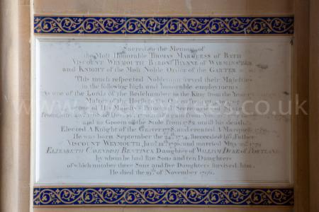
After 19 Nov 1796. Saints Peter and Paul Church, Longbridge Deverill [Map]. Memorial to Thomas Thynne 1st Marquess of Bath (deceased).
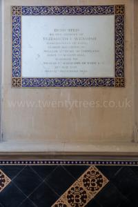
On 12 Dec 1825 Elizabeth Bentinck Marchioness Bath (age 90) died. Memorial in Saints Peter and Paul Church, Longbridge Deverill [Map].
Elizabeth Bentinck Marchioness Bath:
On 27 Jun 1735 she was born to William Bentinck 2nd Duke Portland and Margaret Cavendish Harley 2nd Duchess Portland at Welbeck Abbey. In 1759 Thomas Thynne 1st Marquess of Bath and she were married. She by marriage Viscountess Weymouth. She the daughter of William Bentinck 2nd Duke Portland and Margaret Cavendish Harley 2nd Duchess Portland. They were third cousins.

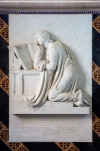
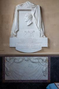
On 01 May 1830 Isabella Elizabeth Byng Marchioness Bath (age 56) died. Monument in Saints Peter and Paul Church, Longbridge Deverill [Map]. Probably sculpted by Francis Leggatt Chantrey (age 49).
Isabella Elizabeth Byng Marchioness Bath:
On 21 Sep 1773 she was born to George Byng 4th Viscount Torrington and Lucy Boyle Viscountess Torrington.
On 14 Apr 1794 Thomas Thynne 2nd Marquess of Bath and she were married. He the son of Thomas Thynne 1st Marquess of Bath and Elizabeth Bentinck Marchioness Bath.

 On 19 Nov 1796 Thomas Thynne 1st Marquess of Bath died. His son Thomas Thynne 2nd Marquess of Bath succeeded 2nd Marquess of Bath, 4th Viscount Weymouth, 5th Baronet Thynne of Kempsford in Gloucestershire. She by marriage Marchioness of Bath.
On 27 Mar 1837 Thomas Thynne 2nd Marquess of Bath (age 72) died. His son Henry Frederick Thynne 3rd Marquess of Bath (age 39) succeeded 3rd Marquess of Bath, 5th Viscount Weymouth, 6th Baronet Thynne of Kempsford in Gloucestershire. Harriet Baring Marchioness Bath (age 32) by marriage Marchioness of Bath. Monument in Saints Peter and Paul Church, Longbridge Deverill [Map] sculpted by Francis Leggatt Chantrey (age 55).
Henry Frederick Thynne 3rd Marquess of Bath: On 04 May 1797 he was born to Thomas Thynne 2nd Marquess of Bath and Isabella Elizabeth Byng Marchioness Bath. On 19 Apr 1830 Henry Frederick Thynne 3rd Marquess of Bath and Harriet Baring Marchioness Bath were married. He the son of Thomas Thynne 2nd Marquess of Bath and Isabella Elizabeth Byng Marchioness Bath. On 24 Jun 1837 Henry Frederick Thynne 3rd Marquess of Bath died. His son John Alexander Thynne 4th Marquess of Bath succeeded 4th Marquess of Bath, 6th Viscount Weymouth, 7th Baronet Thynne of Kempsford in Gloucestershire. The Times. 27 Jan 1916. The death of Lady Ulrica Thynne took place on Wednesday at 30, Grosvenor-gardens. She was the second daughter of the 12th Duke of Somerset and was born in 1833. She married, in 1858, Lord Henry Frederick Thynne, second son of the third Marquess of Bath, who was Treasurer of the Household to Queen Victoria and for over 25 years M.P. for South Wilts. There were four sons and two daughters of the marriage. The funeral will be at Findon, near Worthing, on Monday, at 1 o'clock.
Harriet Baring Marchioness Bath: On 03 May 1804 she was born to Alexander Baring 1st Baron Ashburton and Ann Louisa Bingham Baroness Ashburton. On 02 Jan 1892 Harriet Baring Marchioness Bath died.

Europe, British Isles, South-West England, Wiltshire, Warminster, Oxendean Long Barrow [Map]
Oxendean Long Barrow is also in South England Neolithic Long Barrows.
Wiltshire Archaeological Magazine 1913 V38 Pages 379-414. Warminster1. 6. [Oxendean Long Barrow [Map]] By Oxendean, N. of Battlesbury Camp, W. of the Imber — Warminster road. Length 106ft.; S.E. and N.W. Opened by Cunnington and Hoare, who found "an interment of a skeleton near the centre2, in a cist cut in the native soil beneath the floor of the barrow; and over it, near the surface, was a small cup of rude British pottery."3 It was re-opened by Thurnam, who found the remains of the skeleton but with no further result. This barrow is on unploughed ground, in good condition, with ditches well defined, especially on the N.E. side. O.M. 52 NW.; A. W. I. 66; Arch. xlii. 180.
Note 1. Thurnam refers to this barrow as "Warminster."
Note 2. Thurnam remarks that the burial was nearer the E. end than this description implies.
Note 3. Stourhead Catalogue. Number 202.