

Dove Holes, Derbyshire is in High Peak, Derbyshire.
1881. Census. Dove Holes, Derbyshire [Map].
Joseph Fletcher [aged 51]. 51. Limestone Quarry Man.
Sarah Yates [aged 45]. Wife. 45.
John Fletcher [aged 19]. Son. 19. Limestone Getter.

On 31st December 1883 John Fletcher [aged 21] and Emma Stafford were married at St Thomas Becket's Church, Chapel en le Frith [Map]. He was resident at Dove Holes, Derbyshire [Map], she at Wormhill, Derbyshire [Map].
After Townend [Map] The Street, Derbyshire continues past Lower Eaves [Map], Windy Walls Farm [Map], Sittinglow [Map], Martinside Cross [Map] and more or less through Dove Holes Railway Station [Map] where it makes a slight change in direction. Thereafter it intersects with another Roman Road from Batham Gate before reaching Brooke House Farm [Map] and continuing past St Peter's Church, Buxton [Map] aka Aquae Arnemetiae aka Baths of the Grove Goddess.
In Buxton the route is unknown other than the discovery in Jun 1862 of a milstone at a property called Silverlands [Map] in Buxton: 'In June 1862, there was found in a garden, in the occupation of Mr. Matthew Lees, near the Silverlands in Higher Buxton, the lower part of an inscribed Roman milestone.' The milestone appears to mark twelve miles from the station Navio.1
In 1913 the son of Matthew Lees returned to Buxton from Canada and stated that he was the actual discoverer of the milestone and that he found it while digging deep in his father's garden near an old lane in 1856, not 1862. The stone was lying flat, some 18ins below the surface and the exact spot so far as he could tell was just inside the gateway leading to the Upper Buxton Railway Station. It is suggested that it was found close to its original position and must therefore indicate the line of the Roman road between Buxton and Brough.2
The milestone is now in Buxton Museum.
1. Article in serial: Watkin, W. 1885. 'The Roman Stations Of Derbyshire' Derbyshire Archaeology Journal. Volume 7. pp 79-80.
2. Article in serial: Tristram, E. 1916. 'Roman Buxton', in Derbyshire Archaeological Journal. Vol. 38, pp. 84-104. pp 87-91.
Bull Ring Barrow [Map]. Historic England:
On the south-west side of the henge, c.20m distant, is a large mound interpreted as an oval barrow overlain on its western end by a later bowl barrow. It is sub-rectangular in shape and measures 27m by 21m by c.2.5m high. Originally it would have been somewhat higher but has been disturbed on the summit by a World War II slit trench. Its current plan is due to modern disturbance round its edges, caused by ploughing and the construction and later removal of drystone walls on its east and north sides. No recorded excavation of the barrow has been carried out so it cannot be precisely dated.
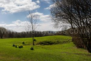
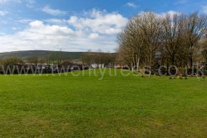
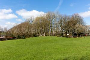
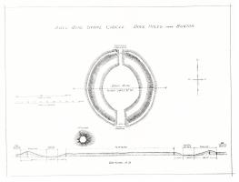
Derbyshire Archaeological Journal Volume 37 1915 Page 77. The Stone Circle, known as the Bull Ring [Map], at Dove Holes, and the Mound [Map] Adjoining1. By Edward Tristram, F.S.A
Note 1. This paper, in a somewhat curtailed form, was read at the Meeting of the Annual Meeting of the Society, at Buxton, in 1912.
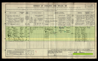
On 2nd April 1911. Census: Buxton Road [Map].
John Fletcher [aged 49]. Head. 48. Quarry man Stone Blaster.
Emma Stafford. Wife. 47.
Edith Fletcher [aged 15]. Daughter. 15.
Edith Fletcher: On 25th February 1896 she was born to John Fletcher and Emma Stafford. In January 1920 Charles Hadfield and she were married.
After Townend [Map] The Street, Derbyshire continues past Lower Eaves [Map], Windy Walls Farm [Map], Sittinglow [Map], Martinside Cross [Map] and more or less through Dove Holes Railway Station [Map] where it makes a slight change in direction. Thereafter it intersects with another Roman Road from Batham Gate before reaching Brooke House Farm [Map] and continuing past St Peter's Church, Buxton [Map] aka Aquae Arnemetiae aka Baths of the Grove Goddess.
In Buxton the route is unknown other than the discovery in Jun 1862 of a milstone at a property called Silverlands [Map] in Buxton: 'In June 1862, there was found in a garden, in the occupation of Mr. Matthew Lees, near the Silverlands in Higher Buxton, the lower part of an inscribed Roman milestone.' The milestone appears to mark twelve miles from the station Navio.1
In 1913 the son of Matthew Lees returned to Buxton from Canada and stated that he was the actual discoverer of the milestone and that he found it while digging deep in his father's garden near an old lane in 1856, not 1862. The stone was lying flat, some 18ins below the surface and the exact spot so far as he could tell was just inside the gateway leading to the Upper Buxton Railway Station. It is suggested that it was found close to its original position and must therefore indicate the line of the Roman road between Buxton and Brough.2
The milestone is now in Buxton Museum.
1. Article in serial: Watkin, W. 1885. 'The Roman Stations Of Derbyshire' Derbyshire Archaeology Journal. Volume 7. pp 79-80.
2. Article in serial: Tristram, E. 1916. 'Roman Buxton', in Derbyshire Archaeological Journal. Vol. 38, pp. 84-104. pp 87-91.
After Townend [Map] The Street, Derbyshire continues past Lower Eaves [Map], Windy Walls Farm [Map], Sittinglow [Map], Martinside Cross [Map] and more or less through Dove Holes Railway Station [Map] where it makes a slight change in direction. Thereafter it intersects with another Roman Road from Batham Gate before reaching Brooke House Farm [Map] and continuing past St Peter's Church, Buxton [Map] aka Aquae Arnemetiae aka Baths of the Grove Goddess.
In Buxton the route is unknown other than the discovery in Jun 1862 of a milstone at a property called Silverlands [Map] in Buxton: 'In June 1862, there was found in a garden, in the occupation of Mr. Matthew Lees, near the Silverlands in Higher Buxton, the lower part of an inscribed Roman milestone.' The milestone appears to mark twelve miles from the station Navio.1
In 1913 the son of Matthew Lees returned to Buxton from Canada and stated that he was the actual discoverer of the milestone and that he found it while digging deep in his father's garden near an old lane in 1856, not 1862. The stone was lying flat, some 18ins below the surface and the exact spot so far as he could tell was just inside the gateway leading to the Upper Buxton Railway Station. It is suggested that it was found close to its original position and must therefore indicate the line of the Roman road between Buxton and Brough.2
The milestone is now in Buxton Museum.
1. Article in serial: Watkin, W. 1885. 'The Roman Stations Of Derbyshire' Derbyshire Archaeology Journal. Volume 7. pp 79-80.
2. Article in serial: Tristram, E. 1916. 'Roman Buxton', in Derbyshire Archaeological Journal. Vol. 38, pp. 84-104. pp 87-91.
After Townend [Map] The Street, Derbyshire continues past Lower Eaves [Map], Windy Walls Farm [Map], Sittinglow [Map], Martinside Cross [Map] and more or less through Dove Holes Railway Station [Map] where it makes a slight change in direction. Thereafter it intersects with another Roman Road from Batham Gate before reaching Brooke House Farm [Map] and continuing past St Peter's Church, Buxton [Map] aka Aquae Arnemetiae aka Baths of the Grove Goddess.
In Buxton the route is unknown other than the discovery in Jun 1862 of a milstone at a property called Silverlands [Map] in Buxton: 'In June 1862, there was found in a garden, in the occupation of Mr. Matthew Lees, near the Silverlands in Higher Buxton, the lower part of an inscribed Roman milestone.' The milestone appears to mark twelve miles from the station Navio.1
In 1913 the son of Matthew Lees returned to Buxton from Canada and stated that he was the actual discoverer of the milestone and that he found it while digging deep in his father's garden near an old lane in 1856, not 1862. The stone was lying flat, some 18ins below the surface and the exact spot so far as he could tell was just inside the gateway leading to the Upper Buxton Railway Station. It is suggested that it was found close to its original position and must therefore indicate the line of the Roman road between Buxton and Brough.2
The milestone is now in Buxton Museum.
1. Article in serial: Watkin, W. 1885. 'The Roman Stations Of Derbyshire' Derbyshire Archaeology Journal. Volume 7. pp 79-80.
2. Article in serial: Tristram, E. 1916. 'Roman Buxton', in Derbyshire Archaeological Journal. Vol. 38, pp. 84-104. pp 87-91.
After Townend [Map] The Street, Derbyshire continues past Lower Eaves [Map], Windy Walls Farm [Map], Sittinglow [Map], Martinside Cross [Map] and more or less through Dove Holes Railway Station [Map] where it makes a slight change in direction. Thereafter it intersects with another Roman Road from Batham Gate before reaching Brooke House Farm [Map] and continuing past St Peter's Church, Buxton [Map] aka Aquae Arnemetiae aka Baths of the Grove Goddess.
In Buxton the route is unknown other than the discovery in Jun 1862 of a milstone at a property called Silverlands [Map] in Buxton: 'In June 1862, there was found in a garden, in the occupation of Mr. Matthew Lees, near the Silverlands in Higher Buxton, the lower part of an inscribed Roman milestone.' The milestone appears to mark twelve miles from the station Navio.1
In 1913 the son of Matthew Lees returned to Buxton from Canada and stated that he was the actual discoverer of the milestone and that he found it while digging deep in his father's garden near an old lane in 1856, not 1862. The stone was lying flat, some 18ins below the surface and the exact spot so far as he could tell was just inside the gateway leading to the Upper Buxton Railway Station. It is suggested that it was found close to its original position and must therefore indicate the line of the Roman road between Buxton and Brough.2
The milestone is now in Buxton Museum.
1. Article in serial: Watkin, W. 1885. 'The Roman Stations Of Derbyshire' Derbyshire Archaeology Journal. Volume 7. pp 79-80.
2. Article in serial: Tristram, E. 1916. 'Roman Buxton', in Derbyshire Archaeological Journal. Vol. 38, pp. 84-104. pp 87-91.
After Townend [Map] The Street, Derbyshire continues past Lower Eaves [Map], Windy Walls Farm [Map], Sittinglow [Map], Martinside Cross [Map] and more or less through Dove Holes Railway Station [Map] where it makes a slight change in direction. Thereafter it intersects with another Roman Road from Batham Gate before reaching Brooke House Farm [Map] and continuing past St Peter's Church, Buxton [Map] aka Aquae Arnemetiae aka Baths of the Grove Goddess.
In Buxton the route is unknown other than the discovery in Jun 1862 of a milstone at a property called Silverlands [Map] in Buxton: 'In June 1862, there was found in a garden, in the occupation of Mr. Matthew Lees, near the Silverlands in Higher Buxton, the lower part of an inscribed Roman milestone.' The milestone appears to mark twelve miles from the station Navio.1
In 1913 the son of Matthew Lees returned to Buxton from Canada and stated that he was the actual discoverer of the milestone and that he found it while digging deep in his father's garden near an old lane in 1856, not 1862. The stone was lying flat, some 18ins below the surface and the exact spot so far as he could tell was just inside the gateway leading to the Upper Buxton Railway Station. It is suggested that it was found close to its original position and must therefore indicate the line of the Roman road between Buxton and Brough.2
The milestone is now in Buxton Museum.
1. Article in serial: Watkin, W. 1885. 'The Roman Stations Of Derbyshire' Derbyshire Archaeology Journal. Volume 7. pp 79-80.
2. Article in serial: Tristram, E. 1916. 'Roman Buxton', in Derbyshire Archaeological Journal. Vol. 38, pp. 84-104. pp 87-91.