Before 5th November 1704 [his father] Christopher Pegge and [his mother] Getrude Stephenson were married.
On 5th November 1704 Samuel Pegge was born to Christopher Pegge and Getrude Stephenson.
In 1722 Samuel Pegge [aged 17] became a pensioner and scholar of St John's College, Cambridge University [Map], graduating BA in 1725, MA in 1729.
In 1723 [his father] Christopher Pegge died.
On 21st March 1726 Samuel Pegge [aged 21] was elected to a lay fellowship on the Beresford foundation of his college but was removed in favour of Michael Burton (afterwards vice-master of St. John's), who claimed founder's kin.
In 1730 Samuel Pegge [aged 25] was elected to the Spalding Gentlemen's Society.
On 13th April 1732 Samuel Pegge [aged 27] and Anne Clarke were married.
In July 1746 [his wife] Anne Clarke died.
Derbyshire Archaeological Journal Volume 30 1908 Page 155. 10th June 1761 [Fol. 45.]
Copied from MS of John Mander, of Bakewell.
Arbourlows [Map] viewed by Mr Pegge [aged 56] and myself, 10 June 1761.
There are 2 in the enclosed commons adjoining One Ash ground, the great one is environed (a) by a great circular rampire, whose height sloping is about 7 yards, the foss four yards (b) over, the area (c) flat of 50 yards diameter; round which are 32 very large limestone slabs formerly erect, now flat. This Mr Pegge called a British temple. It has two entrances, one to the East, another to the West1. From that to the East runs a small rampire, winding south westwardly to the 2nd low (D) at the distance of about 4 or 500 yards2. On the NE3 side of the temple near the last entrance upon the rampire stands a large low, or mount of earth supposed a great barrow and is properly the low.
The low D4 is about 18 feet diameter at top, with a large hollow in the middle of its area summitt after the form of a bason, on the S side is a small faint rampire5 of earth with several breaks in it running across the field (at the distance of about 70 feet from the low) from the wall on the W, and across under the wall on wall to the E. N.B., On the W side of the western wall we could find no traces of this rampire, nor any place where it turned. This rampire crossing the Eastern wall as was said before passes quite to the foot of the great rampire of the temple."
Note 1. Mr Manders evidently had the compass bearings on the plan referred to in this MS., wrong. The entrances of the circle are nearly due north and south, and the tumulus is on the south-east.
Note 2. Gib Hill [Map], but its actual distance from the circle is about 300 yds. It is constantly stated by the older writers that this tumulus was connected with the circle by a "rampire." This, however, upon leaving the latter, does not point to Gib Hill [Map], but has a southerly course for about 200 yards, after which it curves to the west, but with a bearing considerably south of the latter, and is then lost. The recent excavations proved that it consists of a small bank and ditch.
Note 3. This tumulus is on the sonth-east.
Note 5. From personal observations, this is very doubtful (J.W.).
Archaeologia Volume 4 Section VIII. Observations on Kit's Cotty House [Map], in Kent. In a Letter to the Honourable Daines Barrington [aged 47], from the Reverend Mr Pegge [aged 69]. Read at the Society of Antiquaries, Jan. 13, 1774.

Archaeologia Volume 7 Section XIII. A Disquisition on the Lows or Barrows in the Peak of Derbyshire, particularly that capital British Monument called Arbelows [Map]. By the Rev. Mr. Pegge [aged 80].
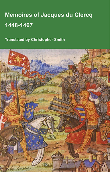
This is a translation of the 'Memoires of Jacques du Clercq', published in 1823 in two volumes, edited by Frederic, Baron de Reissenberg. In his introduction Reissenberg writes: 'Jacques du Clercq tells us that he was born in 1424, and that he was a licentiate in law and a counsellor to Philip the Good, Duke of Burgundy, in the castellany of Douai, Lille, and Orchies. It appears that he established his residence at Arras. In 1446, he married the daughter of Baldwin de la Lacherie, a gentleman who lived in Lille. We read in the fifth book of his Memoirs that his father, also named Jacques du Clercq, had married a lady of the Le Camelin family, from Compiègne. His ancestors, always attached to the counts of Flanders, had constantly served them, whether in their councils or in their armies.' The Memoires cover a period of nineteen years beginning in in 1448, ending in in 1467. It appears that the author had intended to extend the Memoirs beyond that date; no doubt illness or death prevented him from carrying out this plan. As Reissenberg writes the 'merit of this work lies in the simplicity of its narrative, in its tone of good faith, and in a certain air of frankness which naturally wins the reader’s confidence.' Du Clercq ranges from events of national and international importance, including events of the Wars of the Roses in England, to simple, everyday local events such as marriages, robberies, murders, trials and deaths, including that of his own father in Book 5; one of his last entries.
Available at Amazon in eBook and Paperback format.

Archaeologia Volume 8 Section III. 2nd November 1785. Observations by the Rev. Mr. Pegge [aged 80] on the Stanton-Moor Urns, and Druidical Temple [Map]. In a Letter to Major Rooke [aged 62]. Read November 2,. 1785;

Archaeologia Volume 9 Section XVII. Discoveries in opening a Tumulus [Garratts Piece Barrow [Map]] in Derbyshire. In a Letter from the Rev. Mr. Pegge [aged 83] to the Rev. John Brand, Secretary. Read May 8, 1788.
Archaeologia Volume 10 Section IV. Some Observations on the Paintings in the Window of Brereton Church [Map]. By the Rev. Samuel Pegge [aged 85], in a Letter to Owen Salusbury Brereton [aged 74], Esq. Vice President. Read Nov. 26, 1789.

Archaeologia Volume 12 Section I. Antiquities discovered in Derbyshire. In a Letter from Hayman Rooke [aged 70], Esq. F. S. A. to the Rev. Dr. Pegge [aged 89], F. S. A. Read November 21, 1793.
On 14th February 1796 Samuel Pegge [aged 91] died.
father: Christopher Pegge
Grandfather: Francis Stephenson of Unstone, Chesterfield
mother: Getrude Stephenson