Europe, British Isles, South-West England, Wiltshire, Avebury Henge and Stones [Map]
Avebury Henge and Stones is in Avebury, Wiltshire [Map].
Avebury Henge and Stones [Map] describes the monuments associated with the Late Neolithic Early Bronze Age Period, aka around 2400BC. Those monuments are:
Avebury Stone Circles, including:
Avebury North Circle, with the Avebury North Circle Cove [Map] at its centre,
Avebury South Circle, with the Avebury South Circle Obelisk [Map] at its centre,
West Kennet Avenue, with the The Sanctuary [Map] at its end,
Beckhampton Avenue, with the Longstones Cove aka Devil's Quoits [Map] at its end,
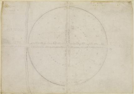
 Jul 1663. John Aubrey (age 37). Ground Plan of Avebury [Map].
In 1943 Alexander Keiller (age 53) sold his holdings in Avebury [Map] to the National Trust for £12,000.
Europe, British Isles, South-West England, Wiltshire, West Kennet, Falkner's Circle [Map]![]()
Falkner's Circle is also in Avebury Stone Circles, .
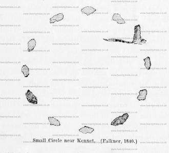
Falkner's Circle [Map] is a 37m diameter Stone Circle of twelve stones, of which only one 1.3m high stone remains, in the Prehistoric Avebury Landscape around 470m south of the Avebury Henge South Entrance [Map] adjacent to the West Kennet Avenue.
Wiltshire Archaeological Magazine 1857 V4 Pages 307-363. 1840. In the dip of the hill between the Kennet avenue and a slight oblong earthwork on the slope of Hakpen Hill,1 a solitary stone is standing. Mr. Falkner of Devizes, has favoured me with the following account of his observations in connection with it. "The stone which you saw in a field on the left, when you went along the avenue towards Kennet, was seen by me in 1840. I went to it, and found it was one of a circle [Falkner's Circle [Map]] that had existed at some former period. There were two other stones lying on the ground, and nine hollow places, from which stones had been removed, making twelve altogether. I made a note of it at the time, and the person with whom I was riding observed it also. The circle was then in a meadow, which was broken up a few years afterwards, and two of the stones removed. The circle was 2824 yards from the nearest part of the avenue. I could not have been mistaken as to the fact of a circle being there, and considered the discovery of sufficient importance to write to the Rev. E. Duke on the subject, who was not aware of what I told him, nor could he explain the matter at all,—only suggesting that the stones might have been set round a large tumulus,—but the ground was quite flat within the circle, which was about 120 feet in diameter."
Note 1. I use the words "Hakpen Hill" because this hill is so designated in the plan, but the Hakpen Hill, properly so called, does not extend so far to the south, or beyond the road leading from Abury to Rockley. See Ordnance Map.
