Text this colour is a link for Members only. Support us by becoming a Member for only £3 a month by joining our 'Buy Me A Coffee page'; Membership gives you access to all content and removes ads.
Text this colour links to Pages. Text this colour links to Family Trees. Place the mouse over images to see a larger image. Click on paintings to see the painter's Biography Page. Mouse over links for a preview. Move the mouse off the painting or link to close the popup.
Letocetum, Staffordshire is in Wall, Staffordshire [Map].
Photos of the remains of the Roman settlement of Letocetum, Staffordshire [Map] including the Mansion and Bath House.
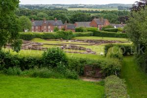
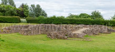
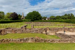
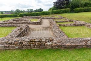
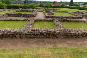
50AD. Letocetum, Staffordshire [Map] was an important military staging post and posting station near the junction of Watling Street and Icknield Street. The settlement developed with successive bath houses and mansiones built to serve the official travellers as well as the growing civilian population. It is known mainly from detailed excavations in 1912-13, which concentrated on the sites of the mansio and bath-house, but there is evidence of a substantial settlement with possible basilica, temples, and amphitheatre.
Icknield Street 18c Wall to Derby. Leaving Letocetum, Staffordshire [Map] aka Wall the Icknield Way takes a new alignment through Lichfield [Map], Streethay [Map], past Alrewas, Staffordshire [Map], through Burton upon Trent, Staffordshire [Map], Toyota Island, Staffordshire [Map] crossing the River Derwent before reaching Derventio [Map] aka Derby.
Icknield Street 18b Alcester to Wall. From Alauna [Map] aka Alcester Icknield Street travels through King's Coughton, Warwickshire [Map], Studley, Warwickshire [Map], Beoley [Map], Forhill Hilltop, Warwickshire [Map], King's Norton, Warwickshire [Map], Metchley Roman Fort, Warwickshire [Map], Kingstanding, Warwickshire [Map], Little Aston, Staffordshire [Map], Shenstone, Staffordshire [Map] before arriving at Ermine Street 2 just south of Letocetum, Staffordshire [Map] aka Wall.
Watling Street 1h Wall to Wroxeter. From Letocetum, Staffordshire [Map] aka Wall Watling Street travels through Muckley Corner, Staffordshire [Map], Brownhills West, Staffordshire [Map], Norton Canes, Staffordshire [Map], Four Crosses, Staffordshire [Map], Gailey, Staffordshire [Map], Pennocrucium, Staffordshire [Map], Weston-under-Lizard, Staffordshire [Map], Uxacona, Staffordshire [Map], Oakengates, Shropshire [Map], Ketley, Shropshire [Map], Overley Hill, Shropshire [Map] ending at Viroconium Cornoviorum [Map] aka Wroxeter.
Watling Street 1g High Cross to Wall. From Venonae [Map] Watling continues north-west through Manduessedum [Map], Atherstone, Warwickshire [Map], Quarry Hill Tamworth [Map], Fazeley, Staffordshire [Map], Bonehill, Staffordshire [Map], Weeford Interchange [Map] to Letocetum, Staffordshire [Map] aka Wall.