The Deeds of the Dukes of Normandy
The Gesta Normannorum Ducum [The Deeds of the Dukes of Normandy] is a landmark medieval chronicle tracing the rise and fall of the Norman dynasty from its early roots through the pivotal events surrounding the Norman Conquest of England. Originally penned in Latin by the monk William of Jumièges shortly before 1060 and later expanded at the behest of William the Conqueror, the work chronicles the deeds, politics, battles, and leadership of the Norman dukes, especially William’s own claim to the English throne. The narrative combines earlier historical sources with firsthand information and oral testimony to present an authoritative account of Normandy’s transformation from a Viking settlement into one of medieval Europe’s most powerful realms. William’s history emphasizes the legitimacy, military prowess, and governance of the Norman line, framing their expansion, including the conquest of England, as both divinely sanctioned and noble in purpose. Later chroniclers such as Orderic Vitalis and Robert of Torigni continued the history, extending the coverage into the 12th century, providing broader context on ducal rule and its impact. Today this classic work remains a foundational source for understanding Norman identity, medieval statesmanship, and the historical forces that reshaped England and Western Europe between 800AD and 1100AD.
Available at Amazon in eBook and Paperback format.
Northumberland Region is in Northumberland.
The Devil's Causeway is a Roman Road from the Portgate, Northumberland [Map], where it crossed Dere Street, to Berwick-upon-Tweed, Northumberland [Map]. It passes through Great Whittingham, Northumberland [Map], Hartburn, Northumberland [Map], where it crosses the Hart Burn, Netherwitton, Northumberland [Map], Longhorsley, Northumberland [Map], Brinkburn Priory, Northumberland [Map], whereit crosses the River Coquet, north of North End [Map], Edlingham, Northumberland [Map] to Learchild Roman Fort [Map] where another road headed west to meet Dere Street at Bremenium [Map] aka High Rochester. The road then continues north passing Glanton, Northumberland [Map], Powburn, Northumberland [Map], where it crosses the River Till aka Breamish, the site of the Battle of Hedgeley Moor [Map], Newtown, Northumberland [Map], East Horton, Northumberland [Map], Lowick, Northumberland [Map], Berrington, Northumberland [Map] before reaching Berwick-upon-Tweed, Northumberland [Map].
The River Font rises near Ewesley, Northumberland [Map] from where it flows past Nunnykirk, Northumberland [Map], Netherwitton, Northumberland [Map], Newton Underwood, Northumberland [Map] to Mitford, Northumberland [Map] where it joins the River Wansbeck.
East to west Stanegate Roman Road started at Corbridge Roman Fort, Northumberland [Map], then passed through Wall, Northumberland [Map], Fourstones, Northumberland [Map], Newbrough, Northumberland [Map], Vindolandia, Northumberland [Map], Haltwhistle Roman Fort [Map], Magnis aka Carvoran Roman Fort [Map], Nether Denton Roman Fort [Map], Brampton Roman Fort [Map] to Carlisle [Map] where the Roman Fort was located where Carlisle Castle is now. The road may possibly have continued to Kirkbride, Cumberland [Map].
On 28th August 1640 the Battle of Newburn was fought at the Newburn, Northumberland [Map] ford over the River Tyne between the Scottish army of 20,000 men commanded by Alexander Leslie 1st Earl Leven [aged 60] and the English army of 5000 commanded by Edward Conway 2nd Viscount Conway [aged 46]. The Scottish army was successful.
On or before 18th March 1695 George Delaval of North Dissington [aged 79] died. He was buried on 18th March 1695 at Newburn, Northumberland [Map].
On 3rd August 1744 Edward Delaval of South Dissington [aged 80] died. He was buried at Newburn, Northumberland [Map].
Newminster Abbey, Northumberland is also in Abbeys in England.
Archaeologia Aeliana Series 4 Volume 32 Pages 126-159. 1281. Richard of Gosebek23 was dead in 1281, holding moieties of Bolam, Aydon and South Middleton, and property at Cowpen24. The property was retained in the king's hands, however, as Margery, his widow, was in Suffolk and unable to take the required oath not to marry again without the king's consent25. A few months later she did homage, took the oath, and was given possession26.
At this time we again find a reference to Shortflatt [Map], in a charter granting land in Greenleighton (Lithdon) to Newminster Abbey [Map], one of the boundaries being defined as "the toft of the lady of Shortflatt" (dominae de Scortfiatte)27. The charter is undated, but it immediately follows one of Richard of Gosebek, and it seems probable that the lady of Shortflatt was Margery of Gosebek.
Note 23. For Richard's trans. with the Jews see Cal. Plea Rolls of Exch. of the Jews, II, 252, 314; and I, 217.
Note 24. I.P.M., 1281—Cal. Inq. Edw. I.
Note 25. I.P.M., 1281
Note 26. Cal. C.R., 1281, October 24th.
Note 27. S.S., LXVI, 90, 92.
On 14th July 1323 Ralph Greystoke 1st Baron Greystoke [aged 23] died at Gateshead, County Durham. Possibly poisoned by a rebel knight. He was buried at Newminster Abbey, Northumberland [Map]. His son William [aged 2] succeeded 2nd Baron Greystoke.
In 1325 Robert Umfraville 8th Earl Angus [aged 48] died. He was buried at Newminster Abbey, Northumberland [Map]. His son Gilbert [aged 15] succeeded 9th Earl Angus.
On 16th July 1350 Joan Willoughby Countess Angus died. She was buried at Newminster Abbey, Northumberland [Map].
On 6th April 1418 Ralph Greystoke 3rd Baron Greystoke [aged 64] died. He was buried at Newminster Abbey, Northumberland [Map]. His son John [aged 29] succeeded 4th Baron Greystoke.
In 1437 Robert Umfraville [aged 74] died. He was buried at Newminster Abbey, Northumberland [Map].
Collectanea by John Leland [1502-1552]. The XXVIth Day of the said Monneth [26th July 1503] the said Qwene departed from the said Place, after the Custome precedent, varey richly and in fayr Aray. And the sayd Mayr conveyd hyr out of the said Towne, and after tuke Lyve of hyr.
Haff a Mylle owt of the said Towne was Syr Hnmfrey Lyde and the Prior of Bryngburn, well apoynted and well horst, to the Nombre of XX Horsys. Their Folks arayd of their Liveray. And a Mylle from the said Towne was in Ordre the Scheryrfe of Northumberlaund, Syr Rawff Evers, in Company of many other Gentylmen, varey well appoynted, their Folks clothed in their Liveray, well monted. And with them wer many honests Folks of the Countre. with Spers and Bowes, in Jackets, to the Nombre of Two hondreth Horsys.
With the sam fayr Company was the said Qwene conveyd to Morpath [Map], and by the Towne passed in fayr Ordre, wher ther was much People; and so she went to the Abbay [Map], where sche was well receyved by th Abbot and Religyous revested, at the Gatt of the Church, with the Crosse. And after the Receyvyng she was conveyd to her Lodgyngs in the said Place for that sam Nyght.
William Greystoke died at Dunbar Castle, Dunbar. He was buried at Dunbar Castle [Map] then reburied at Newminster Abbey, Northumberland [Map].
The Deeds of the Dukes of Normandy
The Gesta Normannorum Ducum [The Deeds of the Dukes of Normandy] is a landmark medieval chronicle tracing the rise and fall of the Norman dynasty from its early roots through the pivotal events surrounding the Norman Conquest of England. Originally penned in Latin by the monk William of Jumièges shortly before 1060 and later expanded at the behest of William the Conqueror, the work chronicles the deeds, politics, battles, and leadership of the Norman dukes, especially William’s own claim to the English throne. The narrative combines earlier historical sources with firsthand information and oral testimony to present an authoritative account of Normandy’s transformation from a Viking settlement into one of medieval Europe’s most powerful realms. William’s history emphasizes the legitimacy, military prowess, and governance of the Norman line, framing their expansion, including the conquest of England, as both divinely sanctioned and noble in purpose. Later chroniclers such as Orderic Vitalis and Robert of Torigni continued the history, extending the coverage into the 12th century, providing broader context on ducal rule and its impact. Today this classic work remains a foundational source for understanding Norman identity, medieval statesmanship, and the historical forces that reshaped England and Western Europe between 800AD and 1100AD.
Available at Amazon in eBook and Paperback format.
In 1249 Constance Gille was born to Thomas Gille at Newsham on Tyne, Northumberland [Map]. She married William Scrope.
The River Font rises near Ewesley, Northumberland [Map] from where it flows past Nunnykirk, Northumberland [Map], Netherwitton, Northumberland [Map], Newton Underwood, Northumberland [Map] to Mitford, Northumberland [Map] where it joins the River Wansbeck.
The Devil's Causeway is a Roman Road from the Portgate, Northumberland [Map], where it crossed Dere Street, to Berwick-upon-Tweed, Northumberland [Map]. It passes through Great Whittingham, Northumberland [Map], Hartburn, Northumberland [Map], where it crosses the Hart Burn, Netherwitton, Northumberland [Map], Longhorsley, Northumberland [Map], Brinkburn Priory, Northumberland [Map], whereit crosses the River Coquet, north of North End [Map], Edlingham, Northumberland [Map] to Learchild Roman Fort [Map] where another road headed west to meet Dere Street at Bremenium [Map] aka High Rochester. The road then continues north passing Glanton, Northumberland [Map], Powburn, Northumberland [Map], where it crosses the River Till aka Breamish, the site of the Battle of Hedgeley Moor [Map], Newtown, Northumberland [Map], East Horton, Northumberland [Map], Lowick, Northumberland [Map], Berrington, Northumberland [Map] before reaching Berwick-upon-Tweed, Northumberland [Map].
The River West Allen rises near Coldcleugh, Northumberland [Map] from where it flows past Carrshield, Northumberland [Map], Ninebanks, Northumberland [Map], Bearsbridge, Northumberland [Map] to just before Cupola Bridge, Northumberland [Map] where it converges with the River East Allen to form the River Allen.
The River Font rises near Ewesley, Northumberland [Map] from where it flows past Nunnykirk, Northumberland [Map], Netherwitton, Northumberland [Map], Newton Underwood, Northumberland [Map] to Mitford, Northumberland [Map] where it joins the River Wansbeck.
The River North Tyne flows from Kielder Water, Northumberland [Map] past Greystead, Northumberland [Map], Bellingham [Map] to Redesmouth, Northumberland [Map] where it is joined by the River Rede.
It continues past Wark, Northumberland [Map], Nunwick, Northumberland [Map], Barrasford, Northumberland [Map], Chollerton, Northumberland [Map], Wall, Northumberland [Map] to Warden, Northumberland [Map] where it joins the River South Tyne to become the River Tyne.
The River Tyne is formed from the River North Tyne and River South Tyne which converge at Warden, Northumberland [Map]. From Warden, Northumberland [Map] it flows past Hexham, Northumberland [Map], Corbridge, Northumberland [Map], Riding Mill, Northumberland [Map], Bywell, Northumberland [Map], Ovingham, Northumberland [Map], Clara Vale, Northumberland [Map], Blaydon, Northumberland [Map], Newcastle upon Tyne, Northumberland [Map] and Wallsend [Map] and North Shields, Northumberland [Map] and South Shields, County Durham [Map] after which it joins the North Sea at Tynemouth, Northumberland [Map].
The River Irthing rises from a number of becks and burns on Padderburn Moor, Northumberland [Map] from where it flows past Churnsike Lodge, Northumberland [Map], Butterburn, Westmoreland and Lampert, Northumberland [Map] where it is joined by the Butter Burn, Smith Farm, Northumberland [Map], Gilsland Spa, Northumberland [Map], Gilsland, Northumberland [Map], Nether Denton, Cumberland [Map], under Lanercost Old Bridge, Cumberland [Map], past Irthington, Cumberland [Map] to Newby East, Cumberland [Map] after which it joins the River Eden.
The River Coquet rises around Chew Green, Northumberland [Map] from where it flows past Makendon Northumberland [Map], Blindburn, Northumberland [Map], Barrow Burn, Northumberland [Map], Shillmoor, Northumberland [Map], Linshiels, Northumberland [Map], Alwinton, Northumberland [Map], Harbottle Castle, Northumberland [Map], Sharperton, Northumberland [Map], Holystone, Northumberland [Map], Hepple, Northumberland [Map], Thropton, Northumberland [Map], Rothbury, Northumberland [Map], Pauperhaugh, Northumberland [Map], Brinkburn Priory, Northumberland [Map], Weldon Bridge, Northumberland [Map], Felton, Northumberland [Map], Guyzance, Northumberland [Map] before passing under the bridge at Warkworth Bridge, Northumberland [Map] and reaching the North Sea at Amble, Northumberland [Map].
The Devil's Causeway is a Roman Road from the Portgate, Northumberland [Map], where it crossed Dere Street, to Berwick-upon-Tweed, Northumberland [Map]. It passes through Great Whittingham, Northumberland [Map], Hartburn, Northumberland [Map], where it crosses the Hart Burn, Netherwitton, Northumberland [Map], Longhorsley, Northumberland [Map], Brinkburn Priory, Northumberland [Map], whereit crosses the River Coquet, north of North End [Map], Edlingham, Northumberland [Map] to Learchild Roman Fort [Map] where another road headed west to meet Dere Street at Bremenium [Map] aka High Rochester. The road then continues north passing Glanton, Northumberland [Map], Powburn, Northumberland [Map], where it crosses the River Till aka Breamish, the site of the Battle of Hedgeley Moor [Map], Newtown, Northumberland [Map], East Horton, Northumberland [Map], Lowick, Northumberland [Map], Berrington, Northumberland [Map] before reaching Berwick-upon-Tweed, Northumberland [Map].
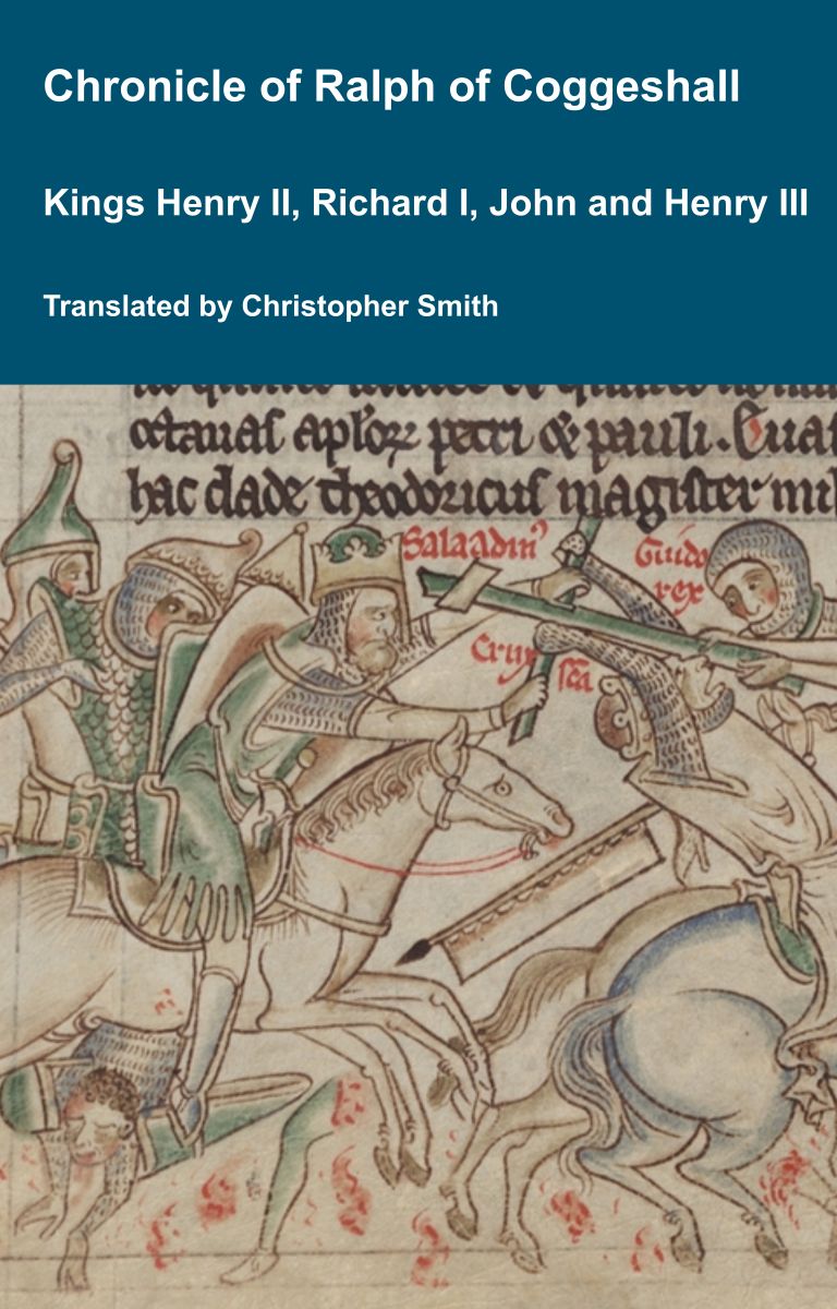
Chronicle of Abbot Ralph of Coggeshall
The Chronicle of Abbot Ralph of Coggeshall (Chronicon Anglicanum) is an indispensable medieval history that brings to life centuries of English and European affairs through the eyes of a learned Cistercian monk. Ralph of Coggeshall, abbot of the Abbey of Coggeshall in Essex in the early 13th century, continued and expanded his community’s chronicle, documenting events from the Norman Conquest of 1066 into the tumultuous reign of King Henry III. Blending eyewitness testimony, careful compilation, and the monastic commitment to record-keeping, this chronicle offers a rare narrative of political intrigue, royal power struggles, and social upheaval in England and beyond. Ralph’s work captures the reigns of pivotal figures such as Richard I and King John, providing invaluable insights into their characters, decisions, and the forces that shaped medieval rule. More than a simple annal, Chronicon Anglicanum conveys the texture of medieval life and governance, making it a rich source for scholars and readers fascinated by English history, monastic authorship, and the shaping of the medieval world.
Available at Amazon in eBook and Paperback format.
The Devil's Causeway is a Roman Road from the Portgate, Northumberland [Map], where it crossed Dere Street, to Berwick-upon-Tweed, Northumberland [Map]. It passes through Great Whittingham, Northumberland [Map], Hartburn, Northumberland [Map], where it crosses the Hart Burn, Netherwitton, Northumberland [Map], Longhorsley, Northumberland [Map], Brinkburn Priory, Northumberland [Map], whereit crosses the River Coquet, north of North End [Map], Edlingham, Northumberland [Map] to Learchild Roman Fort [Map] where another road headed west to meet Dere Street at Bremenium [Map] aka High Rochester. The road then continues north passing Glanton, Northumberland [Map], Powburn, Northumberland [Map], where it crosses the River Till aka Breamish, the site of the Battle of Hedgeley Moor [Map], Newtown, Northumberland [Map], East Horton, Northumberland [Map], Lowick, Northumberland [Map], Berrington, Northumberland [Map] before reaching Berwick-upon-Tweed, Northumberland [Map].
In 1883 John Mounsey Lambert was born to Major-General George Lambert and Isabella Browne at Breamish House, Powburn [Map]. He was educated at Mister Moore's School at Alnmouth and Wellington College.
On 26th September 1836 Colonel William Robert Craster was born to Thomas Wood aka Craster [aged 50] at Preston Tower, Northumberland [Map]. He married 17th June 1868 Mary Joanna Hincks.
The River Coquet rises around Chew Green, Northumberland [Map] from where it flows past Makendon Northumberland [Map], Blindburn, Northumberland [Map], Barrow Burn, Northumberland [Map], Shillmoor, Northumberland [Map], Linshiels, Northumberland [Map], Alwinton, Northumberland [Map], Harbottle Castle, Northumberland [Map], Sharperton, Northumberland [Map], Holystone, Northumberland [Map], Hepple, Northumberland [Map], Thropton, Northumberland [Map], Rothbury, Northumberland [Map], Pauperhaugh, Northumberland [Map], Brinkburn Priory, Northumberland [Map], Weldon Bridge, Northumberland [Map], Felton, Northumberland [Map], Guyzance, Northumberland [Map] before passing under the bridge at Warkworth Bridge, Northumberland [Map] and reaching the North Sea at Amble, Northumberland [Map].
The River Coquet rises around Chew Green, Northumberland [Map] from where it flows past Makendon Northumberland [Map], Blindburn, Northumberland [Map], Barrow Burn, Northumberland [Map], Shillmoor, Northumberland [Map], Linshiels, Northumberland [Map], Alwinton, Northumberland [Map], Harbottle Castle, Northumberland [Map], Sharperton, Northumberland [Map], Holystone, Northumberland [Map], Hepple, Northumberland [Map], Thropton, Northumberland [Map], Rothbury, Northumberland [Map], Pauperhaugh, Northumberland [Map], Brinkburn Priory, Northumberland [Map], Weldon Bridge, Northumberland [Map], Felton, Northumberland [Map], Guyzance, Northumberland [Map] before passing under the bridge at Warkworth Bridge, Northumberland [Map] and reaching the North Sea at Amble, Northumberland [Map].
The River East Allen rises near Allenheads, Northumberland [Map] from where it flows past Ropehaugh, Northumberland [Map], Spartylea, Northumberland [Map], Sinderhope, Northumberland [Map], Allendale Town, Northumberland [Map], Catton, Northumberland [Map] to just before Cupola Bridge, Northumberland [Map] where it converges with the River West Allen to form the River Allen.
The River Irthing rises from a number of becks and burns on Padderburn Moor, Northumberland [Map] from where it flows past Churnsike Lodge, Northumberland [Map], Butterburn, Westmoreland and Lampert, Northumberland [Map] where it is joined by the Butter Burn, Smith Farm, Northumberland [Map], Gilsland Spa, Northumberland [Map], Gilsland, Northumberland [Map], Nether Denton, Cumberland [Map], under Lanercost Old Bridge, Cumberland [Map], past Irthington, Cumberland [Map] to Newby East, Cumberland [Map] after which it joins the River Eden.
The River East Allen rises near Allenheads, Northumberland [Map] from where it flows past Ropehaugh, Northumberland [Map], Spartylea, Northumberland [Map], Sinderhope, Northumberland [Map], Allendale Town, Northumberland [Map], Catton, Northumberland [Map] to just before Cupola Bridge, Northumberland [Map] where it converges with the River West Allen to form the River Allen.
The River Wansbeck rises near Risdale, Northumberland [Map] from where it flows past Kirkwhelpington, Northumberland [Map], Wallington, Northumberland [Map], Low Angerton, Northumberland [Map] to Meldon Park, Northumberland [Map] where it is joined by the Hart Burn.
The River Wansbeck continues through Mitford, Northumberland [Map] where it is joined by the River Font.
After Mitford, Northumberland [Map] the River Wansbeck flows past Morpeth, Northumberland [Map], Guidepost, Northumberland [Map] and Stakeford, Northumberland [Map] before joining the North Sea at Cambois, Northumberland [Map].
The River Blyth rises near Kirkheaton, Northumberland [Map] from where it flows past Bradford [Map], Belsay, Northumberland [Map], Ogle, Northumberland [Map], Kirkley, Northumberland [Map], Horton Grange, Northumberland [Map], Stannington, Northumberland [Map], Bedlington, Northumberland [Map] to Blyth, Northumberland [Map] where it reaches the North Sea.
St Mary's Church, Stannington is also in Churches in Northumberland.

Anne Boleyn. Her Life as told by Lancelot de Carle's 1536 Letter.
In 1536, two weeks after the execution of Anne Boleyn, her brother George and four others, Lancelot du Carle, wrote an extraordinary letter that described Anne's life, and her trial and execution, to which he was a witness. This book presents a new translation of that letter, with additional material from other contemporary sources such as Letters, Hall's and Wriothesley's Chronicles, the pamphlets of Wynkyn the Worde, the Memorial of George Constantyne, the Portuguese Letter and the Baga de Secrets, all of which are provided in Appendices.
Available at Amazon in eBook and Paperback format.
St Mary's Church, Stannington [Map]. Sir Mathew White Ridley (1904) by Sir Mathew White Ridley; bronze effigy with marble base by Detmar Blow
The River Coquet rises around Chew Green, Northumberland [Map] from where it flows past Makendon Northumberland [Map], Blindburn, Northumberland [Map], Barrow Burn, Northumberland [Map], Shillmoor, Northumberland [Map], Linshiels, Northumberland [Map], Alwinton, Northumberland [Map], Harbottle Castle, Northumberland [Map], Sharperton, Northumberland [Map], Holystone, Northumberland [Map], Hepple, Northumberland [Map], Thropton, Northumberland [Map], Rothbury, Northumberland [Map], Pauperhaugh, Northumberland [Map], Brinkburn Priory, Northumberland [Map], Weldon Bridge, Northumberland [Map], Felton, Northumberland [Map], Guyzance, Northumberland [Map] before passing under the bridge at Warkworth Bridge, Northumberland [Map] and reaching the North Sea at Amble, Northumberland [Map].
The River Wansbeck rises near Risdale, Northumberland [Map] from where it flows past Kirkwhelpington, Northumberland [Map], Wallington, Northumberland [Map], Low Angerton, Northumberland [Map] to Meldon Park, Northumberland [Map] where it is joined by the Hart Burn.
The River Wansbeck continues through Mitford, Northumberland [Map] where it is joined by the River Font.
After Mitford, Northumberland [Map] the River Wansbeck flows past Morpeth, Northumberland [Map], Guidepost, Northumberland [Map] and Stakeford, Northumberland [Map] before joining the North Sea at Cambois, Northumberland [Map].
The River Tyne is formed from the River North Tyne and River South Tyne which converge at Warden, Northumberland [Map]. From Warden, Northumberland [Map] it flows past Hexham, Northumberland [Map], Corbridge, Northumberland [Map], Riding Mill, Northumberland [Map], Bywell, Northumberland [Map], Ovingham, Northumberland [Map], Clara Vale, Northumberland [Map], Blaydon, Northumberland [Map], Newcastle upon Tyne, Northumberland [Map] and Wallsend [Map] and North Shields, Northumberland [Map] and South Shields, County Durham [Map] after which it joins the North Sea at Tynemouth, Northumberland [Map].
The River North Tyne flows from Kielder Water, Northumberland [Map] past Greystead, Northumberland [Map], Bellingham [Map] to Redesmouth, Northumberland [Map] where it is joined by the River Rede.
It continues past Wark, Northumberland [Map], Nunwick, Northumberland [Map], Barrasford, Northumberland [Map], Chollerton, Northumberland [Map], Wall, Northumberland [Map] to Warden, Northumberland [Map] where it joins the River South Tyne to become the River Tyne.
The River Coquet rises around Chew Green, Northumberland [Map] from where it flows past Makendon Northumberland [Map], Blindburn, Northumberland [Map], Barrow Burn, Northumberland [Map], Shillmoor, Northumberland [Map], Linshiels, Northumberland [Map], Alwinton, Northumberland [Map], Harbottle Castle, Northumberland [Map], Sharperton, Northumberland [Map], Holystone, Northumberland [Map], Hepple, Northumberland [Map], Thropton, Northumberland [Map], Rothbury, Northumberland [Map], Pauperhaugh, Northumberland [Map], Brinkburn Priory, Northumberland [Map], Weldon Bridge, Northumberland [Map], Felton, Northumberland [Map], Guyzance, Northumberland [Map] before passing under the bridge at Warkworth Bridge, Northumberland [Map] and reaching the North Sea at Amble, Northumberland [Map].
On 24th December 1884 Captain Charles Noel Ridley was born to John H Ridley [aged 35] at Wellborn, Northumberland. He married September 1907 Daphne Bewicke.
The River Aln rises near Alnham, Northumberland [Map] from where it flows past Whittingham, Northumberland [Map], Bolton, Northumberland [Map], Hulne Priory, Northumberland [Map] then passing around Alnwick Castle, Northumberland [Map] before passing Lesbury, Northumberland [Map] then at Alnwick, Northumberland [Map] it joins the North Sea.
Callaly Castle, Whittingham is also in Castles in Northumberland.

By February 1537 Robert Collingwood was advising Thomas Howard 3rd Duke of Norfolk [aged 64] about lawless elements in Redesdale and Tynedale and later he was involved in the attempt to bridle them. He and John Horsley corresponded with Cromwell on border matters and Norfolk, who twice stayed at his house at Eslington [Map], told Cromwell in July 1537 that he trusted Collingwood above all others in that region.
In April 1553 Robert Collingwood paid £766 for a grant to himself and his brother Alexander of ex-monastic property in Northumberland. He had laid the basis of his estates in the county in 1542 when he bought Eslington [Map] from Bertram Haselrigge.
Goodenough Fountain, Whittingham [Map]. In memory of Elizabeth Anne, wife of Reverend R W Goodenough. 1874.


Learchild Roman Fort [Map] fort is preserved as a cropmark or very low earthwork. Partial excavation has shown that the remnant ramparts and below ground features such as ditches will contain important archaeological deposits relating to the construction, development, use and abandonment of the monument. The fort contains two constructional phases and therefore provides insight into the development in Roman military fortifications between the 1st and 2nd centuries AD. More widely the monument also provides insight into the Roman conquest of northern England.
The Devil's Causeway is a Roman Road from the Portgate, Northumberland [Map], where it crossed Dere Street, to Berwick-upon-Tweed, Northumberland [Map]. It passes through Great Whittingham, Northumberland [Map], Hartburn, Northumberland [Map], where it crosses the Hart Burn, Netherwitton, Northumberland [Map], Longhorsley, Northumberland [Map], Brinkburn Priory, Northumberland [Map], whereit crosses the River Coquet, north of North End [Map], Edlingham, Northumberland [Map] to Learchild Roman Fort [Map] where another road headed west to meet Dere Street at Bremenium [Map] aka High Rochester. The road then continues north passing Glanton, Northumberland [Map], Powburn, Northumberland [Map], where it crosses the River Till aka Breamish, the site of the Battle of Hedgeley Moor [Map], Newtown, Northumberland [Map], East Horton, Northumberland [Map], Lowick, Northumberland [Map], Berrington, Northumberland [Map] before reaching Berwick-upon-Tweed, Northumberland [Map].
Henrici Quinti, Angliæ Regis, Gesta, is a first-hand account of the Agincourt Campaign, and subsequent events to his death in 1422. The author of the first part was a Chaplain in King Henry's retinue who was present from King Henry's departure at Southampton in 1415, at the siege of Harfleur, the battle of Agincourt, and the celebrations on King Henry's return to London. The second part, by another writer, relates the events that took place including the negotiations at Troye, Henry's marriage and his death in 1422.
Available at Amazon in eBook and Paperback format.
Ravensworth Statue And Fountain, Whittingham [Map]. 1905. Fountain and statue of Atholl Liddell 3rd Earl of Ravensworth commissioned by Caroline Cecelia Edgecumbe Countess Revensworth and Mount Edgecumbe [aged 65].
Atholl Liddell 3rd Earl of Ravensworth: On 6th August 1833 he was born to Henry Thomas Liddell 1st Earl Ravensworth and Isabella Horatia Seymour. He a great x 4 grandson of King Charles II of England Scotland and Ireland. On 9th October 1866 Atholl Liddell 3rd Earl of Ravensworth and Caroline Cecelia Edgecumbe Countess Revensworth and Mount Edgecumbe were married. He the son of Henry Thomas Liddell 1st Earl Ravensworth and Isabella Horatia Seymour. On 22nd July 1903 Henry Liddell 2nd Earl of Ravensworth died. His brother Atholl succeeded 3rd Earl Ravensworth, 4th Baron Ravensworth of Ravensworth Castle in County Durham, 9th Baronet Liddell of Ravensworth Castle. Caroline Cecelia Edgecumbe Countess Revensworth and Mount Edgecumbe by marriage Countess Ravensworth. On 7th February 1904 Atholl Liddell 3rd Earl of Ravensworth died. Earl Ravensworth extinct. His first cousin Arthur succeeded 5th Baron Ravensworth of Ravensworth Castle in County Durham, 10th Baronet Liddell of Ravensworth Castle. Sophia Harriett Waller Baroness Ravensworth by marriage Baroness Ravensworth of Ravensworth Castle in County Durham.


The Times. 5th February 1929. The funeral of the Earl of Durham [deceased] took place yesterday at Burnmoor. The Countess of Durham [aged 69] who was unable to attend owing to illness, received the following telegram from the Queen [aged 61]:- "I send you and your family my sincere sympathy in your great sorrow.".
The cortege left Fenton [Map] at 11.30, and, as followed by 25 coaches, three of which conveyed wreaths. The chief mourners included Viscount Lambton [aged 44] and Captain the Hon. Claud Lambton [aged 45] (sons). Captain the Hon. D'Arcy Lambton [aged 62], the Hon. George Lambton [aged 68], and the Hon. Charles Lambton [aged 71] (brothers). Viscount Cecil (brother-in-law), the Earl [aged 56] and Countess of Ellesmnere [aged 48] (son-in-law and daughter), the Earl of Home (son-in-law). The officiating clergy were the Rev. Ralph Watson. the Rev. A. J. Gadd, the rector, and the Rev. G. F. Eolme. Tenants from Lord Durham's Fenton Estate were the bearers. A memorial eervice for Lord Durham was held vesterday at St. Peter's. Eaton-square, the Rev. Austin Thompson officiating. Among those present were:- The Hon. Mrs. Charles Lambton. the Bon. Mrs. Claud Lambton, Air. D'Arcy [?]. the Earl and Countess of Pembroke. Colonel the Hon. George Herhert also represented the Dowager Countess of Pembroke. Mr Arthur Lambton, the Duke and Duchess of Abereorn the Dowager Marchioness of Lansdowne Alberta Marchioness of Blanford.


