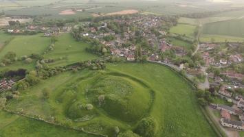
South Kesteven is in Kesteven.
Around 50AD. Ancaster [Map] was the junction of Ermine Street and King Street. During the Romano-British period, the Romans built a roadside settlement on the site of a
King Street is a Roman Road between Peterborough [Map] and Ancaster [Map] where it joins Ermine Street 2. It is numbered 26 in Ivan Margary's book 'Roman Roads in Britain'.
From Peterborough [Map] it travels north through Lolham Bridges [Map] crossing the River Glen at Kates Bridge [Map], through Bourne where Bourne Abbey, Lincolnshire [Map] was later built. The road continues through Cawthorpe [Map], Stainfield, South Kesteven [Map], Hanby, South Kesteven [Map], Sapperton, South Kesteven [Map] before reaching Ermine Street 2 south of Ancaster [Map].
Ermine Street. From Durobrivae [Map] Ermine Street crosses the River Welland at Stamford [Map] then continues through Great Casterton [Map], Colsterworth [Map], Ancaster [Map]. Continuing on a new alignment Ermine Street passes east of Navenby [Map] meeting the Fosse Way at Bracebridge [Map] with both roads continuing together to Lindum Colonia [Map] aka Lincoln.
In 913 Charles Noel Allix sold Willoughby Hall.
In 1794 Charles Allix [aged 78] died. Reverend Charles Wager Allix [aged 46] inherited Willoughby Hall. John Peter Allix [aged 45] inherited Swaffham Prior House.
In 1795 Reverend Charles Wager Allix [aged 47] died. Colonel Charles Allix [aged 11] inherited Willoughby Hall.
On 9th April 1823 Captain William Kent Allix was born to Colonel Charles Allix [aged 40] and Mary Elizabeth Hammond at Willoughby Hall. He was educated at Harrow School where there is a memorial plaque to him.
On 22nd January 1866 Colonel Charles Allix [aged 83] died. He was buried at St Martin's Church, Ancaster [Map]. Frederick William Allix [aged 49] inherited Willoughby Hall.
On 13th October 1894 Frederick William Allix [aged 78] died. Charles Noel Allix [aged 48] inherited Willoughby Hall.
Chronicle of Abbot Ralph of Coggeshall
The Chronicle of Abbot Ralph of Coggeshall (Chronicon Anglicanum) is an indispensable medieval history that brings to life centuries of English and European affairs through the eyes of a learned Cistercian monk. Ralph of Coggeshall, abbot of the Abbey of Coggeshall in Essex in the early 13th century, continued and expanded his community’s chronicle, documenting events from the Norman Conquest of 1066 into the tumultuous reign of King Henry III. Blending eyewitness testimony, careful compilation, and the monastic commitment to record-keeping, this chronicle offers a rare narrative of political intrigue, royal power struggles, and social upheaval in England and beyond. Ralph’s work captures the reigns of pivotal figures such as Richard I and King John, providing invaluable insights into their characters, decisions, and the forces that shaped medieval rule. More than a simple annal, Chronicon Anglicanum conveys the texture of medieval life and governance, making it a rich source for scholars and readers fascinated by English history, monastic authorship, and the shaping of the medieval world.
Available at Amazon in eBook and Paperback format.
The River Witham rises near South Witham, South Kesteven [Map] from where it flows past North Witham, South Kesteven [Map], Colsterworth, South Kesteven [Map], Easton, South Kesteven [Map] to Great Ponton, South Kesteven [Map] where it is joined by the Cringle Brook.
From Great Ponton, South Kesteven [Map] the River Witham flows through Grantham [Map], Belton, Grantham [Map], past Barkston, South Kesteven [Map], Marston, South Kesteven [Map] and Hougham, South Kesteven [Map], Westborough, South Kesteven [Map], Long Benington, South Kesteven [Map], Claypole, South Kesteven [Map], Beckingham, North Kesteven [Map], Norton Disney, North Kesteven [Map], Bassingham, North Kesteven [Map], Haddington, North Kesteven [Map], Aubourn, North Kesteven [Map] through the centre of Lincoln, Lincolnshire [Map] where it joined by the River Till.
From Lincoln, Lincolnshire [Map] it flows under Five Mile Bridge [Map], past Bardney Abbey [Map], Kirkstead [Map], under Tattershall Bridge [Map] after which it is joined by the River Bain
After Tattershall the River Witham flows through canalised sections under Lanrick Bridge [Map], past Anton's Gowt [Map] to Boston [Map] where it is joined by the South Forty Foot Drain. After Boston [Map] the River Witham flows into the The Wash around eight kilometres away.
The South Forty Foot Drain aka Black Sluice is a man-made drain starting at Guthram Gowt [Map] that drains a large area of the Lincolnshire fen-land known as the Black Sluice Area aka Lindsey Level. The drain, or an early version of it was first constructed around 1635 when the Earl of Lindsey agreed with the Commissioners of Sewers for Lincolnshire to carry out drainage works which would make 150 km2 of land available for agricultural use. The South Forty Foot Drain drains the area bounded by Great Hale, North Kesteven [Map], Bourne, South Kesteven [Map], Pinchbeck [Map] and Boston [Map].
Bytham Castle, Lincolnshire [Map] is (probably) a Norman Castle of Motte and Bailey construction. No stonework remains above ground
Photo by Richard Carter, CC BY-SA 2.0.
On 12th May 1335 Margery de Braose [aged 70] died at Bytham Castle, Lincolnshire [Map].
The River Witham rises near South Witham, South Kesteven [Map] from where it flows past North Witham, South Kesteven [Map], Colsterworth, South Kesteven [Map], Easton, South Kesteven [Map] to Great Ponton, South Kesteven [Map] where it is joined by the Cringle Brook.
From Great Ponton, South Kesteven [Map] the River Witham flows through Grantham [Map], Belton, Grantham [Map], past Barkston, South Kesteven [Map], Marston, South Kesteven [Map] and Hougham, South Kesteven [Map], Westborough, South Kesteven [Map], Long Benington, South Kesteven [Map], Claypole, South Kesteven [Map], Beckingham, North Kesteven [Map], Norton Disney, North Kesteven [Map], Bassingham, North Kesteven [Map], Haddington, North Kesteven [Map], Aubourn, North Kesteven [Map] through the centre of Lincoln, Lincolnshire [Map] where it joined by the River Till.
From Lincoln, Lincolnshire [Map] it flows under Five Mile Bridge [Map], past Bardney Abbey [Map], Kirkstead [Map], under Tattershall Bridge [Map] after which it is joined by the River Bain
After Tattershall the River Witham flows through canalised sections under Lanrick Bridge [Map], past Anton's Gowt [Map] to Boston [Map] where it is joined by the South Forty Foot Drain. After Boston [Map] the River Witham flows into the The Wash around eight kilometres away.
The River Witham rises near South Witham, South Kesteven [Map] from where it flows past North Witham, South Kesteven [Map], Colsterworth, South Kesteven [Map], Easton, South Kesteven [Map] to Great Ponton, South Kesteven [Map] where it is joined by the Cringle Brook.
From Great Ponton, South Kesteven [Map] the River Witham flows through Grantham [Map], Belton, Grantham [Map], past Barkston, South Kesteven [Map], Marston, South Kesteven [Map] and Hougham, South Kesteven [Map], Westborough, South Kesteven [Map], Long Benington, South Kesteven [Map], Claypole, South Kesteven [Map], Beckingham, North Kesteven [Map], Norton Disney, North Kesteven [Map], Bassingham, North Kesteven [Map], Haddington, North Kesteven [Map], Aubourn, North Kesteven [Map] through the centre of Lincoln, Lincolnshire [Map] where it joined by the River Till.
From Lincoln, Lincolnshire [Map] it flows under Five Mile Bridge [Map], past Bardney Abbey [Map], Kirkstead [Map], under Tattershall Bridge [Map] after which it is joined by the River Bain
After Tattershall the River Witham flows through canalised sections under Lanrick Bridge [Map], past Anton's Gowt [Map] to Boston [Map] where it is joined by the South Forty Foot Drain. After Boston [Map] the River Witham flows into the The Wash around eight kilometres away.
The River Witham rises near South Witham, South Kesteven [Map] from where it flows past North Witham, South Kesteven [Map], Colsterworth, South Kesteven [Map], Easton, South Kesteven [Map] to Great Ponton, South Kesteven [Map] where it is joined by the Cringle Brook.
From Great Ponton, South Kesteven [Map] the River Witham flows through Grantham [Map], Belton, Grantham [Map], past Barkston, South Kesteven [Map], Marston, South Kesteven [Map] and Hougham, South Kesteven [Map], Westborough, South Kesteven [Map], Long Benington, South Kesteven [Map], Claypole, South Kesteven [Map], Beckingham, North Kesteven [Map], Norton Disney, North Kesteven [Map], Bassingham, North Kesteven [Map], Haddington, North Kesteven [Map], Aubourn, North Kesteven [Map] through the centre of Lincoln, Lincolnshire [Map] where it joined by the River Till.
From Lincoln, Lincolnshire [Map] it flows under Five Mile Bridge [Map], past Bardney Abbey [Map], Kirkstead [Map], under Tattershall Bridge [Map] after which it is joined by the River Bain
After Tattershall the River Witham flows through canalised sections under Lanrick Bridge [Map], past Anton's Gowt [Map] to Boston [Map] where it is joined by the South Forty Foot Drain. After Boston [Map] the River Witham flows into the The Wash around eight kilometres away.
Around 1435 Joan Beaumont Baroness Lovel was born to John Beaumont 1st Viscount Beaumont [aged 25] and Katherine Neville Duchess Norfolk [aged 35] at Edenham, South Kesteven. She a great x 2 granddaughter of King Edward III of England. She married 1. before 1456 her second cousin once removed John Lovell 8th Baron Lovel 5th Baron Holand, son of William Lovell 7th Baron Lovel 4th Baron Holand and Alice Deincourt 6th Baroness Deincourt and Grey, Baroness Lovel and Sudeley, and had issue 2. after 28th February 1463 her half third cousin once removed William Stanley, son of Thomas Stanley 1st Baron Stanley and Jane Goushill Baroness Stanley.
On 22nd July 1779 Robert Bertie 4th Duke Ancaster and Kesteven [deceased] was buried at Edenham, South Kesteven.
The River Witham rises near South Witham, South Kesteven [Map] from where it flows past North Witham, South Kesteven [Map], Colsterworth, South Kesteven [Map], Easton, South Kesteven [Map] to Great Ponton, South Kesteven [Map] where it is joined by the Cringle Brook.
From Great Ponton, South Kesteven [Map] the River Witham flows through Grantham [Map], Belton, Grantham [Map], past Barkston, South Kesteven [Map], Marston, South Kesteven [Map] and Hougham, South Kesteven [Map], Westborough, South Kesteven [Map], Long Benington, South Kesteven [Map], Claypole, South Kesteven [Map], Beckingham, North Kesteven [Map], Norton Disney, North Kesteven [Map], Bassingham, North Kesteven [Map], Haddington, North Kesteven [Map], Aubourn, North Kesteven [Map] through the centre of Lincoln, Lincolnshire [Map] where it joined by the River Till.
From Lincoln, Lincolnshire [Map] it flows under Five Mile Bridge [Map], past Bardney Abbey [Map], Kirkstead [Map], under Tattershall Bridge [Map] after which it is joined by the River Bain
After Tattershall the River Witham flows through canalised sections under Lanrick Bridge [Map], past Anton's Gowt [Map] to Boston [Map] where it is joined by the South Forty Foot Drain. After Boston [Map] the River Witham flows into the The Wash around eight kilometres away.
The Cringle Brook near Buckminster, Leicestershire [Map] from where it flows past Skillington, South Kesteven [Map] and Stoke Rochford [Map] before joining the River Witham at Great Ponton, South Kesteven [Map].
The True Chronicles of Jean le Bel Volume 2 Chapters 61-109 1342-1361
The Chronicle of Jean le Bel, Volume 2 continues one of the most important fourteenth-century accounts of the early Hundred Years’ War. Written by the Liège chronicler Jean le Bel, this vivid narrative follows the fortunes of Edward III, Jean II of France, the Black Prince, the great nobles of France and England, and the soldiers, captains and companies who shaped the conflict. This volume covers some of the most dramatic events of the period, including the battles of Crécy and Poitiers, the siege and capture of Calais, the captivity of King John, the rise of the Jacquerie, the turmoil in Paris under Étienne Marcel and Charles of Navarre, the devastation caused by the free companies, Edward III’s great campaign of 1359–1360, and the negotiations leading to the Treaty of Brétigny. Jean le Bel’s chronicle is especially valuable for its lively detail, its interest in chivalry, warfare, politics and reputation, and its influence on later chroniclers, most famously Froissart. This English translation presents the text in clear, readable British English while preserving the force and character of the original narrative. The translation includes extensive notes to help the reader better understand Jean le Bel's text. Volume 2 also includes translated appendices drawn from royal and administrative records, many from the English Record Office, which illuminate Edward III’s campaigns in Brittany, the siege and occupation of Calais, naval preparations, military finance, appointments, safe conducts and related affairs.
Available at Amazon in eBook and Paperback format.
King Street is a Roman Road between Peterborough [Map] and Ancaster [Map] where it joins Ermine Street 2. It is numbered 26 in Ivan Margary's book 'Roman Roads in Britain'.
From Peterborough [Map] it travels north through Lolham Bridges [Map] crossing the River Glen at Kates Bridge [Map], through Bourne where Bourne Abbey, Lincolnshire [Map] was later built. The road continues through Cawthorpe [Map], Stainfield, South Kesteven [Map], Hanby, South Kesteven [Map], Sapperton, South Kesteven [Map] before reaching Ermine Street 2 south of Ancaster [Map].
Honington, South Kesteven.
Our church is open for visitors and individual prayer from 9 am to 4 pm each day
Monument to Sir William Hussey, d.1691.
"In Memory Of Sarah Hussey Wife Of Robert Ap Reece, Of Washingley, In The County Of Huntingdon, Esqre. She Was The Daughter And Heir Of Sir Thomas Hussey Of Huntingdon, Bart. Descended From The 2nd Brother Of The Right Honble. John, Lord Hussey, Baron Of Sleeford, And Lord Lieutenant Of The County Of Lincoln. This Family Did Derive Their Descent From The Ancient Barons Hoese, Or Huse: Temp. Hen. Iii. And Edw. I. Ii. & Iii. She Died The 23d Of April, 1749."
Portrait bust of Sir Thomas Hussey bart., d.1698.
"On the north wall, monuments to Sir William Hussey, d.1691 and Dame Sarah Hussey d.1697 with broken pediment, scrolly cartouches and cherubs"
"Monuments:- those in the north aisle are a notable collection; on the east wall is a marble plaque to Sir Thomas Hussey bart., d.1698 with a gadrooned base supporting a portrait bust and surmounted by a scrolly cartouche bearing a shield of arms. On the north wall, monuments to Sir William Hussey, d.1691 and Dame Sarah Hussey d.1697 with broken pediment, scrolly cartouches and cherubs. Also an altar tomb in the north east angle of the chapel to Thomas Hussey, son of Sir Thomas, d.1676 aged 15 years, black marble ledger slab above limestone tomb chest"
The River Witham rises near South Witham, South Kesteven [Map] from where it flows past North Witham, South Kesteven [Map], Colsterworth, South Kesteven [Map], Easton, South Kesteven [Map] to Great Ponton, South Kesteven [Map] where it is joined by the Cringle Brook.
From Great Ponton, South Kesteven [Map] the River Witham flows through Grantham [Map], Belton, Grantham [Map], past Barkston, South Kesteven [Map], Marston, South Kesteven [Map] and Hougham, South Kesteven [Map], Westborough, South Kesteven [Map], Long Benington, South Kesteven [Map], Claypole, South Kesteven [Map], Beckingham, North Kesteven [Map], Norton Disney, North Kesteven [Map], Bassingham, North Kesteven [Map], Haddington, North Kesteven [Map], Aubourn, North Kesteven [Map] through the centre of Lincoln, Lincolnshire [Map] where it joined by the River Till.
From Lincoln, Lincolnshire [Map] it flows under Five Mile Bridge [Map], past Bardney Abbey [Map], Kirkstead [Map], under Tattershall Bridge [Map] after which it is joined by the River Bain
After Tattershall the River Witham flows through canalised sections under Lanrick Bridge [Map], past Anton's Gowt [Map] to Boston [Map] where it is joined by the South Forty Foot Drain. After Boston [Map] the River Witham flows into the The Wash around eight kilometres away.
The River Witham rises near South Witham, South Kesteven [Map] from where it flows past North Witham, South Kesteven [Map], Colsterworth, South Kesteven [Map], Easton, South Kesteven [Map] to Great Ponton, South Kesteven [Map] where it is joined by the Cringle Brook.
From Great Ponton, South Kesteven [Map] the River Witham flows through Grantham [Map], Belton, Grantham [Map], past Barkston, South Kesteven [Map], Marston, South Kesteven [Map] and Hougham, South Kesteven [Map], Westborough, South Kesteven [Map], Long Benington, South Kesteven [Map], Claypole, South Kesteven [Map], Beckingham, North Kesteven [Map], Norton Disney, North Kesteven [Map], Bassingham, North Kesteven [Map], Haddington, North Kesteven [Map], Aubourn, North Kesteven [Map] through the centre of Lincoln, Lincolnshire [Map] where it joined by the River Till.
From Lincoln, Lincolnshire [Map] it flows under Five Mile Bridge [Map], past Bardney Abbey [Map], Kirkstead [Map], under Tattershall Bridge [Map] after which it is joined by the River Bain
After Tattershall the River Witham flows through canalised sections under Lanrick Bridge [Map], past Anton's Gowt [Map] to Boston [Map] where it is joined by the South Forty Foot Drain. After Boston [Map] the River Witham flows into the The Wash around eight kilometres away.
The River Witham rises near South Witham, South Kesteven [Map] from where it flows past North Witham, South Kesteven [Map], Colsterworth, South Kesteven [Map], Easton, South Kesteven [Map] to Great Ponton, South Kesteven [Map] where it is joined by the Cringle Brook.
From Great Ponton, South Kesteven [Map] the River Witham flows through Grantham [Map], Belton, Grantham [Map], past Barkston, South Kesteven [Map], Marston, South Kesteven [Map] and Hougham, South Kesteven [Map], Westborough, South Kesteven [Map], Long Benington, South Kesteven [Map], Claypole, South Kesteven [Map], Beckingham, North Kesteven [Map], Norton Disney, North Kesteven [Map], Bassingham, North Kesteven [Map], Haddington, North Kesteven [Map], Aubourn, North Kesteven [Map] through the centre of Lincoln, Lincolnshire [Map] where it joined by the River Till.
From Lincoln, Lincolnshire [Map] it flows under Five Mile Bridge [Map], past Bardney Abbey [Map], Kirkstead [Map], under Tattershall Bridge [Map] after which it is joined by the River Bain
After Tattershall the River Witham flows through canalised sections under Lanrick Bridge [Map], past Anton's Gowt [Map] to Boston [Map] where it is joined by the South Forty Foot Drain. After Boston [Map] the River Witham flows into the The Wash around eight kilometres away.
St Mary's Church, Marston, South Kesteven [Map]. Open every day. Churchwarden Mrs Barbara Barrodale telephone: 01522 826381
In south chapel, a large dresser tomb of pink and white marble with alabaster recumbent figure flanked by corinthian columns, of Sir Anthony Thorold, died June 1594. Backing onto it at east end of south aisle, another dresser tomb of stone and marble with 3 shields in medillions below and quatrefoil frieze above, of William Thorold, died 1569. Alabaster monument on south wall to Anne, Lady Hodgson (nee Thorold), died 1719, with ornate crown and apron, flanking corinthianesque pilasters and draperies.
On 26th June 1594 Anthony Thorold [aged 74] died. He was buried at St Mary's Church, Marston, South Kesteven [Map].
King Street is a Roman Road between Peterborough [Map] and Ancaster [Map] where it joins Ermine Street 2. It is numbered 26 in Ivan Margary's book 'Roman Roads in Britain'.
From Peterborough [Map] it travels north through Lolham Bridges [Map] crossing the River Glen at Kates Bridge [Map], through Bourne where Bourne Abbey, Lincolnshire [Map] was later built. The road continues through Cawthorpe [Map], Stainfield, South Kesteven [Map], Hanby, South Kesteven [Map], Sapperton, South Kesteven [Map] before reaching Ermine Street 2 south of Ancaster [Map].
The Cringle Brook near Buckminster, Leicestershire [Map] from where it flows past Skillington, South Kesteven [Map] and Stoke Rochford [Map] before joining the River Witham at Great Ponton, South Kesteven [Map].
The River Witham rises near South Witham, South Kesteven [Map] from where it flows past North Witham, South Kesteven [Map], Colsterworth, South Kesteven [Map], Easton, South Kesteven [Map] to Great Ponton, South Kesteven [Map] where it is joined by the Cringle Brook.
From Great Ponton, South Kesteven [Map] the River Witham flows through Grantham [Map], Belton, Grantham [Map], past Barkston, South Kesteven [Map], Marston, South Kesteven [Map] and Hougham, South Kesteven [Map], Westborough, South Kesteven [Map], Long Benington, South Kesteven [Map], Claypole, South Kesteven [Map], Beckingham, North Kesteven [Map], Norton Disney, North Kesteven [Map], Bassingham, North Kesteven [Map], Haddington, North Kesteven [Map], Aubourn, North Kesteven [Map] through the centre of Lincoln, Lincolnshire [Map] where it joined by the River Till.
From Lincoln, Lincolnshire [Map] it flows under Five Mile Bridge [Map], past Bardney Abbey [Map], Kirkstead [Map], under Tattershall Bridge [Map] after which it is joined by the River Bain
After Tattershall the River Witham flows through canalised sections under Lanrick Bridge [Map], past Anton's Gowt [Map] to Boston [Map] where it is joined by the South Forty Foot Drain. After Boston [Map] the River Witham flows into the The Wash around eight kilometres away.
The True Chronicles of Jean le Bel Volume 2 Chapters 61-109 1342-1361
The Chronicle of Jean le Bel, Volume 2 continues one of the most important fourteenth-century accounts of the early Hundred Years’ War. Written by the Liège chronicler Jean le Bel, this vivid narrative follows the fortunes of Edward III, Jean II of France, the Black Prince, the great nobles of France and England, and the soldiers, captains and companies who shaped the conflict. This volume covers some of the most dramatic events of the period, including the battles of Crécy and Poitiers, the siege and capture of Calais, the captivity of King John, the rise of the Jacquerie, the turmoil in Paris under Étienne Marcel and Charles of Navarre, the devastation caused by the free companies, Edward III’s great campaign of 1359–1360, and the negotiations leading to the Treaty of Brétigny. Jean le Bel’s chronicle is especially valuable for its lively detail, its interest in chivalry, warfare, politics and reputation, and its influence on later chroniclers, most famously Froissart. This English translation presents the text in clear, readable British English while preserving the force and character of the original narrative. The translation includes extensive notes to help the reader better understand Jean le Bel's text. Volume 2 also includes translated appendices drawn from royal and administrative records, many from the English Record Office, which illuminate Edward III’s campaigns in Brittany, the siege and occupation of Calais, naval preparations, military finance, appointments, safe conducts and related affairs.
Available at Amazon in eBook and Paperback format.
King Street is a Roman Road between Peterborough [Map] and Ancaster [Map] where it joins Ermine Street 2. It is numbered 26 in Ivan Margary's book 'Roman Roads in Britain'.
From Peterborough [Map] it travels north through Lolham Bridges [Map] crossing the River Glen at Kates Bridge [Map], through Bourne where Bourne Abbey, Lincolnshire [Map] was later built. The road continues through Cawthorpe [Map], Stainfield, South Kesteven [Map], Hanby, South Kesteven [Map], Sapperton, South Kesteven [Map] before reaching Ermine Street 2 south of Ancaster [Map].